Contact EPA Pacific Southwest Water Division
Pacific Southwest, Region 9
Serving: Arizona, California, Hawaii, Nevada, Pacific Islands, Tribal Nations
Watershed Priorities
Santa Cruz Watershed, Arizona
Santa Cruz River Public Survey Research
EPA's Office of Research and Development, Western Ecology Division is investigating how urban households value different possibilities for the Santa Cruz River in southern Arizona. A random sample of households in the Phoenix and Tucson areas are being asked to provide their point of view on the Santa Cruz River management possibilities. Two lengths of the wastewater-dependent river (PDF) (About PDF) ![]() are considered in the survey: a “South” length starting at a treated wastewater outfall in Rio Rico, AZ and flowing northward through Tumacácori National Historical Park; and a “North” length, fed by two treated wastewater outfalls in northwest Tucson, AZ and flowing northwest through Marana, AZ.
are considered in the survey: a “South” length starting at a treated wastewater outfall in Rio Rico, AZ and flowing northward through Tumacácori National Historical Park; and a “North” length, fed by two treated wastewater outfalls in northwest Tucson, AZ and flowing northwest through Marana, AZ.
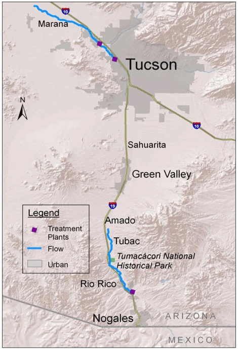
NORTH
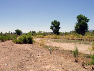
Treated wastewater now supports about 20 miles of flow, and about 125 acres of forest along the river. The flow starts in NW Tucson near Prince Rd and I-10 and flows past Marana.
SOUTH
Treated wastewater now supports about 17 miles of flow, and about 460 acres of forest along the river. The flow starts in southern Rio Rico and flows past Tubac.
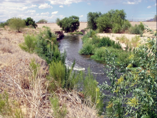
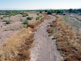
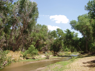
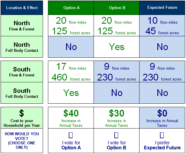
For both the south and north lengths of the Santa Cruz River, two different scenarios of change are considered. The first is a reduction in flow length, and associated decreases in cottonwood-willow riparian forest, a rare forest type in the region. The second is an increase in water quality to allow full contact recreation, such as submersion, at normal flow levels. The baseline flow length and forest acreages, as well as the acreages of forest that would be associated with reduced flow lengths, are derived from natural science research conducted at the University of Arizona and Arizona State University. Text as well as photos are used to describe what impacts treated wastewater have on the ecosystem. An important finding from focus group research conducted in developing the survey was that few people were aware of these areas of treated wastewater flow in the river.
The survey includes a series of questions asking whether households would be willing to pay more in annual taxes for varying options of maintaining current river flow lengths and areas of forest, and increasing wastewater quality to allow full contact recreation in the river. Each question allows a zero cost "opt out" option. The responses will provide information on the public value of the river and forest.
Additional questions to further understand resident knowledge of the Santa Cruz River, general motivations for their responses, as well as their river-related recreation behavior, are also included. Limited sociodemographic questions are included to compare sample respondent sociodemographics with the target urban populations. The OMB approval number for the survey is 2080-0080.
The project contributes to EPA's research on community sustainability and ecosystem service identification and valuation. This is the first known example of a valuation survey being conducted in-house by the EPA Office of Research and Development.
For more information on the survey, see the materials posted with the full notice ![]() .
.
Contact Information
Matt Weber, PhD (weber.matthew@epa.gov)
USEPA, ORD, Western Ecology Division
(541) 754-4315