Lake Michigan
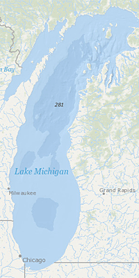 Lake Michigan, by volume, is the second largest Great Lake and the only one located wholly within the United States. The northern part is in the colder, less-developed upper Great Lakes region. It is sparsely populated, except for the Fox River Valley, and is primarily covered with mixed wood forest. The more temperate southern basin of Lake Michigan is the most urbanized area in the Great Lakes system; it contains the Milwaukee and Chicago metropolitan areas.
Geophysical Lake Michigan
- Lake Michigan Lakewide Action and Management Plans
- Lake Michigan LAMP Annual Reports
- Other Lake Michigan Plans and Reports
- Lake Michigan Great Lakes Areas of Concern (AOCs)
Lake Michigan Lakewide Action and Management Plans (LAMPs)
Under the Great Lakes Water Quality Agreement (GLWQA), the governments of Canada and the United States have committed to restore and maintain the physical, biological and chemical integrity of the waters of the Great Lakes.
The Lakewide Action and Management Plans (LAMPs) are action plans for restoring and protecting the Great Lakes ecosystem.
Lake Michigan LAMP Annual Reports
The LAMP Annual Reports highlight accomplishments and progress in achieving LAMP goals during the past year and identifies LAMP-related activities including outreach, monitoring, and protection and restoration actions.
Other Lake Michigan Reports and Planning Documents
- Sensitivity of Coastal Environments and Wildlife to Spilled Oil Southern Lake Michigan - Environmental Sensitivity Index Maps for the Lake Michigan Shorelines of Indiana and Illinois
- Lake Michigan Mass Balance Project (LMMB)
- Lake Michigan Habitat and Land Use Management Tool Box
- Lake Michigan Intensive Survey 1976-1977 Management Report (EPA-90-480-003B)
- Zooplankton Community Composition In Nearshore Waters Of Southern Lake Michigan (EPA-905-382-001)
Lake Michigan Great Lakes Areas of Concern (AOCs)
- Green Bay Fox River AOC - Wisconsin
- Grand Calumet River AOC - Indiana
- Kalamazoo River AOC - Michigan
- Manistique River AOC - Michigan
- Menominee River AOC - Michigan
- Milwaukee Estuary AOC - Wisconsin
- Muskegon Lake AOC - Michigan
- Sheboygan River AOC - Michigan
- Waukegan Harbor AOC - Wisconsin
- White Lake AOC - Michigan - DELISTED