The 2011 NATA app is a mapping application available on the web and on mobile devices that displays risks, emissions, and monitoring data on a map. It also allows the querying and downloading of data. Map layers include:
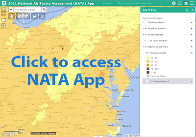 all emissions sources modeled in NATA,
- cancer risks and respiratory hazard indices,
- annual ambient concentrations, and
- air toxics monitoring sites with monitoring data spanning the years 2005 to 2013.
Map popups for the risk layers provide information on contributions to risk from each source group and each pollutant. Popups for the emissions layers provide all the emissions from the sources, in tons per year. There are query options for cancer risk and respiratory hazard index by risk level, by state, by county, and by census tract number. Point sources can be queried by EIS ID and spatially by user-defined shapes. The monitoring data can be queried by pollutant and state.