Level III and IV Ecoregions of the Continental United States
Select a link for additional details about each level, including links to downloadable maps and GIS data files.
- Level III Ecoregions
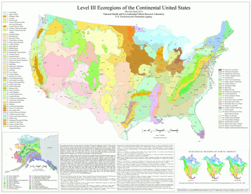 Level III Ecoregions of the Continental United States (select map for larger PDF version)
Level III Ecoregions Downloads
(NOTE: maps and GIS files may differ. To make sure you are using the most current ecoregion data, download shapefiles of ecoregions)
GIS data (shapefiles, metadata and symbology):
- US Level III Ecoregions shapefile with state boundaries (35 mb)
- US Level III Ecoregions shapefile without state boundaries (28 mb)
- US Level III Ecoregions Metadata and US Level III Ecoregions Symbology
- Instructions for applying symbology to ecoregions
Maps (PDF Format):
- US Level III Ecoregions--30" X 23" (3.8 mb)
- US Level III Ecoregions with Hillshading--30" X 23" (16 mb)
- US Level III Ecoregions with North America Hillshading--30" X 23" (33.7 mb)
Ecoregion Descriptions (MSWord documents):
- Level IV Ecoregions
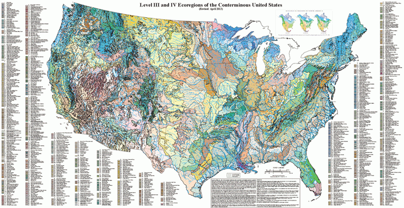 Level IV Ecoregions of the Conterminous United States (select map for larger PDF version)
(NOTE: maps and GIS files may differ. To make sure you are using the most current ecoregion data, download shapefiles of ecoregions)
GIS data (shapefiles, metadata and symbology):
- US Level IV Ecoregions shapefile with state boundaries (69 mb)
- US Level IV Ecoregions shapefile without state boundaries (65 mb)
- US Level IV Ecoregions Metadata and US Level IV Ecoregions Symbology
- Instructions for applying symbology to ecoregions
Maps (PDF Format):