Ecoregions
Background
Ecoregions are areas where ecosystems (and the type, quality, and quantity of environmental resources) are generally similar. This ecoregion framework is derived from Omernik (1987) and from mapping done in collaboration with EPA regional offices, other Federal agencies, state resource management agencies, and neighboring North American countries. Designed to serve as a spatial framework for the research, assessment, and monitoring of ecosystems and ecosystem components, ecoregions denote areas of similarity in the mosaic of biotic, abiotic, terrestrial, and aquatic ecosystem components with humans being considered as part of the biota. These regions are critical for structuring and implementing ecosystem management strategies across Federal agencies, state agencies, and nongovernmental organizations that are responsible for different types of resources within the same geographic areas (Omernik and Griffith 2014, McMahon et al. 2001).
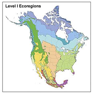
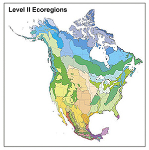
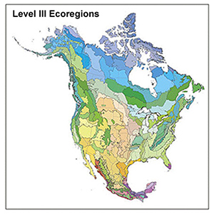
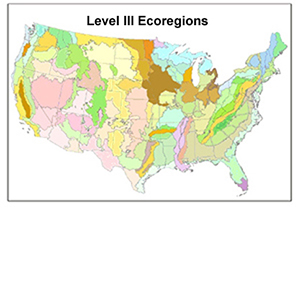
Ecoregions are identified by analyzing the patterns and composition of biotic and abiotic phenomena that affect or reflect differences in ecosystem quality and integrity (Omernik 1987, 1995). These phenomena include geology, landforms, soils, vegetation, climate, land use, wildlife, and hydrology. The relative importance of each characteristic varies from one ecological region to another regardless of the hierarchical level. A Roman numeral classification scheme has been adopted for different hierarchical levels of ecoregions, ranging from general regions to more detailed:
- Level I - 12 ecoregions in the continental U.S.
- Level II - 25 ecoregions in the continental U.S.
- Level III -105 ecoregions in the continental U.S.
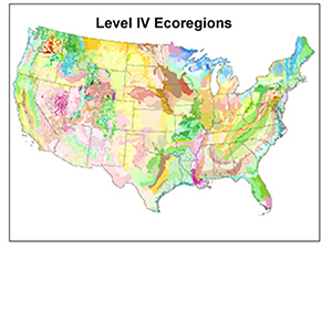
- Level IV - 967 ecoregions in the conterminous U.S.
Explanations of the methods used to define these multi-agency ecoregions are given in Omernik and Griffith (2014), Omernik (1995, 2004), and CEC (1997).
References
Commission for Environmental Cooperation. 1997. Ecological regions of North America: toward a common perspective. Commission for Environmental Cooperation, Montreal, Quebec, Canada. 71p. Map (scale 1:12,500,000). Revised 2006.
McMahon, G., S.M. Gregonis, S.W. Waltman, J.M. Omernik, T.D. Thorson, J.A. Freeouf, A.H. Rorick, and J.E. Keys. 2001. Developing a spatial framework of common ecological regions for the conterminous United States. Environmental Management 28(3):293-316.
Omernik, J.M. 1987. Ecoregions of the conterminous United States. Map (scale 1:7,500,000). Annals of the Association of American Geographers 77(1):118-125.
Omernik, J.M. 1995. Ecoregions: A spatial framework for environmental management. In: Biological Assessment and Criteria: Tools for Water Resource Planning and Decision Making. Davis, W.S. and T.P. Simon (eds.), Lewis Publishers, Boca Raton, FL. p. 49-62.
Omernik, J.M. 2004. Perspectives on the nature and definition of ecological regions. Environmental Management 34(Supplement 1):S27-S38.
Omernik, J.M. and G.E. Griffith. 2014. Ecoregions of the conterminous United States: evolution of a hierarchical spatial framework. Environmental Management 54(6):1249-1266.
Downloads
To view or download printable ecoregions maps and GIS datasets for spatial analysis, go to the pages in the Ecoregions Maps & GIS Data box above.
For Further Information
See Ecoregions Publications for links to additional details about ecoregions.
James Omernik: omernik.james@epa.gov / 541-754-4458
Glenn Griffith: ggriffith@usgs.gov / 541-754-4465
Randy Comeleo: comeleo.randy@epa.gov / 541-754-4491
Western Ecology Division
200 SW 35th St
Corvallis, OR 97333