Learn About Watershed Index Online (WSIO)
 A watershed – the land area that drains to one stream, lake or river – affects the water quality in the water body that it surrounds. Like water bodies (e.g., lakes, rivers, and streams), individual watersheds have similarities but also differ in many ways. Healthy watersheds not only maintain good water quality but also provide benefits to the communities of people and wildlife that live there. Every inch of the USA is part of a watershed – in other words, all lands drain into a lake, river, stream or other water body and directly affect its quality. We all live in a watershed, thus watershed condition is important to everyone.
Comparing watershed differences is one way in which citizens, communities and their government agencies learn about their environment, identify water pollution control options, and plan for effective lake, river or stream restoration and protection. There are literally hundreds of watershed characteristics (such as environmental traits, sources of degradation and community factors) that may influence water quality, environmental health and quality of life.
The Watershed Index Online (WSIO) is a comparative analysis tool and data library that helps its users compare watersheds in a user-defined geographic area, for a purpose of their choice, using the ecological, stressor, and social factors that they consider most relevant to that purpose for comparison. The WSIO utilizes an online, customizable tool creation process, along with a watershed indicator data library that encompasses several hundred watershed characteristics nationwide. After visiting WSIO, users take away a custom-designed watershed analysis tool for their area of interest, pre-loaded with the watershed data they have selected, for later use on their own computers.
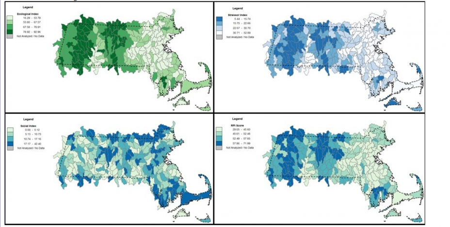
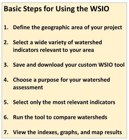
 Instructions in a Nutshell. After opening the WSIO tool (a specially coded Excel spreadsheet), a WSIO user first chooses a geographic area for their project and then selects watershed indicators of interest from a menu. The WSIO creates the user’s own custom tool that is based on the selected geographic area and contains all the data for the user-selected indicators. The user saves their custom tool copy for use offline on their desktop, where they can use various combinations of the indicators they selected to perform watershed screening-level comparisons. For each screening run, the tool auto-calculates ecological, stressor, and social indicator scores, as well as a combined Watershed Index score. The tool also creates ranked lists, graphs and maps of the watersheds for use in reports, presentations, and informal discussions.
For less technical users. Although the WSIO User Manual provides detailed directions on all steps, the tool may seem complex to less technically trained users. If the process of defining your project area and selecting your indicators of highest interest seems too complex or time-consuming, you can simply download a pre-made tool for your whole state at the Download Statewide Tools page. The statewide tools perform nearly all of the same functions as the online WSIO tool, and they have over 200 indicators for every HUC12 watershed in the state already embedded in the tool. All you have to do is download your statewide tool, and learn to use the tool for statewide or sub-state areas of interest to you. After becoming familiar with the statewide tool, you may find that you can revisit the WSIO with more understanding and create exactly the custom tool you want.
Detailed, step by step instructions are available in the WSIO User Manual
