About St. Clair River AOC
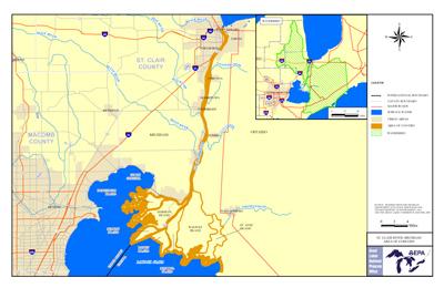 St. Clair River AOC Boundary Map
The St. Clair River flows southward through Michigan about 40 miles connecting the southern tip of Lake Huron to Lake St. Clair. The river branches into several channels near its mouth at Lake St. Clair, creating a broad delta region. The Area of Concern includes these important wetlands from St. Johns Marsh on the west to the north shore of Mitchell's Bay in Ontario. The river is part of the boundary between the United States and Canada.
Sources of Pollution
- Unregulated discharges from municipal and industrial facilities, including petroleum refineries, chemical manufacturers, paper mills, salt producers and electric power plants
- Waste disposal sites
- Landfills
- Urban and agricultural runoff
- Atmospheric deposition
These sources have contributed PCBs, mercury, heavy metals, phosphorus and polycyclic aromatic hydrocarbons (PAHs).
Beneficial Use Impairments
- Restrictions on fish and wildlife consumption
- Tainting of fish and wildlife flavor – REMOVED 2012
- Restrictions on drinking water consumption, or taste and odor
- Beach closings
- Degradation of aesthetics – REMOVED 2012
- Bird or animal deformities or reproduction problems
- Added costs to agriculture or industry – REMOVED 2011
- Degradation of benthos – REMOVED 2014
- Restriction on dredging activities – REMOVED 2009
- Loss of fish and wildlife habitat