Lake Ontario
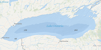 Lake Ontario is the last of the chain of Great Lakes that straddle the Canada/United States border. Since Lake Ontario is the downstream Great Lake, it is impacted by human activities occurring throughout the Lake Superior, Michigan, Huron, and Erie basins. Geophysical Lake Ontario
- Lake Ontario Lakewide Action and Management Plans
- Lake Ontario LAMP Annual Reports
- Other Lake Ontario Plans and Reports
- Lake Ontario Great Lakes Areas of Concern
Lake Ontario Lakewide Action and Management Plans
Under the Great Lakes Water Quality Agreement, the governments of Canada and the United States have committed to restore and maintain the physical, biological and chemical integrity of the waters of the Great Lakes.
The Lakewide Action and Management Plans (LAMPs) are binational action plans for restoring and protecting the Great Lakes ecosystem.
Lake Ontario LAMP Annual Reports
LAMP annual reports highlight accomplishments and progress in achieving LAMP goals during the previous year; they identify LAMP-related activities including outreach, monitoring, and protection and restoration actions.
Other Lake Ontario Plans and Reports
- Implementing a Lake Ontario LAMP Biodiversity Conservation Strategy April 2011
- Lake Ontario Tributaries: 2009-2010 Field Data Report March 2011
- Niagara River Toxics Management Plan Annual Status Reports
- Niagara River Toxics Management Plan Progress Reports and Work Plans
The key elements of the Lake Ontario LAMP's Binational Biodiversity Conservation Strategy are:
- integration of action priorities into existing programs and "place-based" planning activities especially within key watersheds, an activity best done by local governments and organizations
- regional coordination of lakewide scale biodiversity monitoring and restoration activities.
Lake Ontario Great Lakes Areas of Concern (AOCs)
- Eighteenmile Creek AOC - New York
- Niagara River AOC - New York
- Oswego River AOC - New York - DELISTED
- Rochester Embayment AOC - New York
- St. Lawrence River AOC - New York and St. Lawrence River AOC - Canada Exit
- Hamilton Harbour AOC - Canada Exit
- Toronto and Region AOC - Canada Exit
- Port Hope Harbour AOC - Canada Exit
- Bay of Quinte AOC - Canada Exit