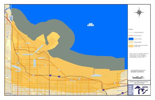
About the Grand Calumet River AOC
 Printable boundary map and shapefile of Grand Calumet River AOC
The Grand Calumet River, originating in the east end of Gary, Indiana, flows 13 miles through the heavily industrialized cities of Gary, East Chicago and Hammond. It was named an Area of Concern under the Great Lakes Water Quality Agreement of 1987. All 14 beneficial uses were determined to be impaired.
- contaminated sediments
- industrial waste site runoff
- Superfund sites
- Resource Conservation and Recovery Act hazardous waste sites
- underground storage tanks
- atmospheric deposition
- urban runoff
- contaminated groundwater
The largest extent of the impairment to the AOC comes from legacy pollutants found in the sediments at the bottom of the Grand Calumet River and Indiana Harbor and Ship Canal. Contaminants include PCBs, PAHs and heavy metals such as mercury, cadmium, chromium and lead. High fecal coliform bacteria levels, biochemical oxygen demand, suspended solids, and oil and grease create additional problems.
- The east branch of the river
- A small segment of the west branch
- The bottom of the Grand Calumet River and Indiana Harbor and Ship Canal
- Ilinois/Indiana state line
Beneficial Use Impairments
- Restrictions on fish and wildlife consumption
- Eutrophication
 EutrophicationThe normally slow aging process by which a lake evolves into a bog or marsh and ultimately assumes a completely terrestrial state and disappears. During eutrophication the lake becomes so rich in nutritive compounds, especially nitrogen and phosphorus, that algae and other microscopic plant life become superabundant, thereby "choking" the lade, and causing it eventually to dry up. Eutrophication may be accelerated by human activities. or undesirable algae
 - Harming of fish and wildlife flavor
- Restrictions on drinking water consumption, or taste and odor REMOVED 2012
- Degradation of fish and wildlife populations
- Beach closings
- Fish tumors or other deformities
- Degradation of aesthetics
- Bird or animal deformities or reproduction problems
- Added costs to agriculture or industry REMOVED 2011
- Degradation of benthos
- Degradation of phytoplankton and zooplankton populations
- Restriction on dredging activities
- Loss of fish and wildlife habitat
