WhAEM2000 BBM Files - Texas (West)
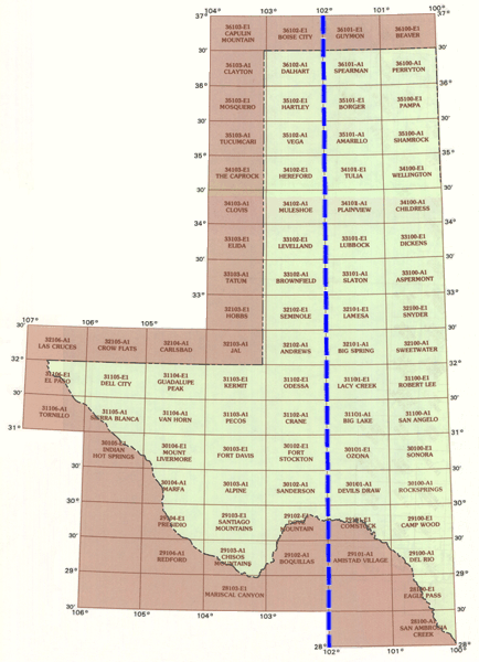
To find binary base map data for a specific geographic area, click on the appropriate 30 by 60 minute quadrangle on the state map below. A Web page containing a graphic of the 30 by 60 minute quadrangle will display eight subdivided 15 by 15 minute quadrangles. Alternatively, you can choose from an alphabetical text list of available 30 by 60 minute quadrangles.

| Alpine | Amarillo | Amistad Village | Andrews | Aspermont | Biglake | Big Spring | Boquillas | Borger | Brownfield | Camp Wood | Childress | Chisos Mountains | Clayton | Clovis | Comstock | Crane | Dalhart | Del Rio | Dell City | Devils Draw | Dickens | Dove Mountain | Eaglepa | El Paso | Elida | Fort Davis | Fort Stockton | Guadalupe Peak | Hartley | Hereford | Hobbs | Indian Hot Springs | Jal | Kermit | Lacy Creek | Lamesa | Levelland | Lubbock | Marfa | Mariscal Canyon | Mosquero | Mount Livermore | Muleshoe | Odessa | Ozona | Pampa | Pecos | Perryton | Plainview | Presidio | Redford | Robert Lee | Rocksprings | San Ambrosia Creek | San Angelo | Sanderson | Santiago Mountains | Seminole | Shamrock | Sierra Blanca | Slaton | Snyder | Sonora | Spearman | Sweetwater | Tatum | The Caprock | Tornillo | Tucumcari | Tulia | Vanhorn | Vega | Wellington |
