What EPA is Doing with Watershed Index Online (WSIO)
On this page: 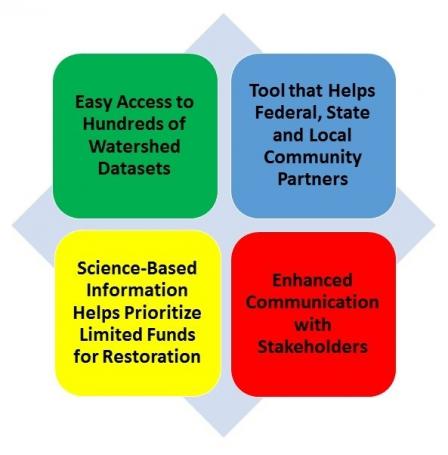
Restoring and Maintaining US Waters Requires Good Information. The Clean Water Act’s primary goal is to restore and maintain the integrity of the nation’s waters. Despite this law’s many pollution control successes, tens of thousands of streams, rivers and lakes have been reported as still impaired. The great majority of these involve pollution sources in their watersheds -- the land area that surrounds and drains into these waters. Knowing the conditions in watersheds is crucial for restoring areas with degraded water quality, as well as protecting healthy waters from emerging problems before expensive damages occur. Achieving the Clean Water Act’s main goal depends on having good information about watersheds -- their environmental conditions, possible pollution sources, and factors that may influence restoration and protection of water quality. EPA is investing in developing WSIO from scientifically sound and consistent sources, and making this information public and easily accessible to the wide variety of our partners working toward clean and healthy waters.
EPA’s Partners Need Assistance. EPA has substantial responsibilities under the Clean Water Act, and implements these by working closely with states, authorized tribes and territories. Further, EPA assists and partners with a wide variety of other local- to national-scale partners that include communities, local agencies and private organizations, corporations, and other federal agencies involved in activities to improve or protect water quality. Although these partners are involved in a very wide variety of activities, watershed information and some form of comparative assessment is typically a crucial part. Often, they must make hard decisions on where to invest limited efforts and funds among more problem areas than they can address. EPA’s development of WSIO helps limited budgets go farther by centrally compiling and providing watershed information key to local and state decisions and actions. Their projects spend less on data development, leaving more resources available to improve water quality.
The Data are Out There and Need to be Made Accessible. Although more and more national datasets on environmental characteristics have become available, few have taken the extra step of transforming information into factors most relevant to water quality. For example, a national dataset showing the presence of agriculture may have some value in recognizing possible sources of water pollution. However, translating this data into watershed indicators, such as the percentage of agriculture on steep slopes or close to streams, is necessary to discern potential risks from non-risk situations. WSIO makes data more applicable by measuring water-quality-relevant indicators on a watershed by watershed basis. These include hundreds of ecological, stressor, and social characteristics of watersheds that may improve or degrade water quality.
In addition, using most national datasets requires advanced GIS skills and software, which reduces the number of users substantially. By transforming these data into simple watershed indicators, then making them accessible in a common spreadsheet application (Excel) coded to calculate indices for watershed comparison, WSIO opens the door to a greater audience of users. Moreover, the WSIO tool still generates rank-ordered tables, graphs and simple maps that can be customized for presentations and reports.
Everyone’s Watershed Interests and Needs are Not Alike. For very many reasons, the WSIO is not a ‘one size fits all’ analytical tool. There are countless purposes for wanting to compare watersheds and make better-informed decisions. Also, different parts of the nation have very different environments. Building in the ability of the WSIO user to customize their tool, and their analysis, was crucial. In particular, WSIO users get to define their own geographic area of interest, then choose the indicators most relevant to it. They can weight the indicators differently if desired. What’s more, users are not limited to the WSIO indicator library and can add more indicators to their custom tool from outside sources. The end result is a flexible, public source of relevant data and useful tools that can be tailored to a wide variety of efforts to restore and maintain healthy waters across the nation.
For More Information on EPA and WSIO. Please also visit the following:
About WSIO (PDF) (13 pp, 732 KB) – a more detailed account of the approach, purpose, development, and characteristics of WSIO.
Recovery Potential Screening – an EPA comparative watershed assessment tool utilized by many state water programs to set priorities for restoration. This project contributes to and utilizes WSIO indicator data, and provided the framework for the WSIO tool’s development.
Healthy Watersheds Protection – an EPA program dedicated to assessing and protecting waters and watersheds before they become severely degraded. Its assessments use many of the indicators compiled in WSIO to describe watershed health and vulnerability.
EPA EnviroAtlas – an EPA research program website that documents ecological goods and services of watersheds nationally. This project contributes to and utilizes WSIO indicator data.