Storm Water Management Model (SWMM)
Version 5.1.011 with Low Impact Development (LID) Controls
Description
EPA's Storm Water Management Model (SWMM) is used throughout the world for planning, analysis and design related to stormwater runoff, combined and sanitary sewers, and other drainage systems in urban areas. There are many applications for drainage systems in non-urban areas as well.
SWMM is a dynamic hydrology-hydraulic water quality simulation model. It is used for single event or long-term (continuous) simulation of runoff quantity and quality from primarily urban areas. The runoff component operates on a collection of sub catchment areas that receive precipitation and generate runoff and pollutant loads. The routing portion transports this runoff through a system of pipes, channels, storage/treatment devices, pumps, and regulators.
SWMM tracks the quantity and quality of runoff made within each sub catchment. It tracks the flow rate, flow depth, and quality of water in each pipe and channel during a simulation period made up of multiple time steps. SWMM 5 has recently been extended to model the hydrologic performance of specific types of low impact development (LID) controls. The LID controls that the user can choose include the following seven green infrastructure practices:
- Permeable pavement
- Rain gardens
- Green roofs
- Street planters
- Rain barrels
- Infiltration trenches
- Vegetative swales
The updated model allows engineers and planners to accurately represent any combination of LID controls within a study area to determine their effectiveness in managing stormwater and combined sewer overflows.
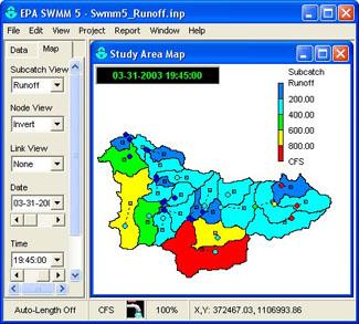
Running under Windows, SWMM 5 provides an integrated environment for editing study area input data; running hydrologic, hydraulic and water quality simulations; and viewing the results in a variety of formats. The latter includes
- color-coded drainage area and conveyance system maps,
- time series graphs and tables,
- profile plots, and
- statistical frequency analyses.
SWMM 5 was produced in a joint development effort with CDM, Inc., a global consulting, engineering, construction, and operations firm.
Capabilities
SWMM accounts for various hydrologic processes that produce runoff from urban areas. These include
- time-varying rainfall,
- evaporation of standing surface water,
- snow accumulation and melting,
- rainfall interception from depression storage,
- infiltration of rainfall into unsaturated soil layers,
- percolation of infiltrated water into groundwater layers,
- interflow between groundwater and the drainage system,
- nonlinear reservoir routing of overland flow, and
- runoff reduction via LID controls.
Spatial variability in all of these processes is achieved by dividing a study area into a collection of smaller, homogeneous sub catchment areas. Each of the areas contains its own fraction of pervious and impervious sub-areas. Overland flow can be routed between sub-areas, between sub-catchments, or between entry points of a drainage system.
SWMM contains a flexible set of hydraulic modeling capabilities used to route runoff and external inflows through the drainage system network of pipes, channels, storage/treatment units and diversion structures. These include the ability to
- handle drainage networks of unlimited size;
- use a wide variety of standard closed and open conduit shapes as well as natural channels;
- model special elements such as storage/treatment units, flow dividers, pumps, weirs, and orifices;
- apply external flows and water quality inputs from surface runoff, groundwater interflow, rainfall-dependent infiltration/inflow, dry weather sanitary flow, and user-defined inflows;
- utilize either kinematic wave or full dynamic wave flow routing methods;
- model various flow regimes, such as backwater, surcharging, reverse flow, and surface ponding; and
- apply user-defined dynamic control rules to simulate the operation of pumps, orifice openings, and weir crest levels.
SWMM can estimate the production of pollutant loads associated with stormwater runoff. The following processes can be modeled for any number of user-defined water quality constituents:
- Dry-weather pollutant buildup over different land uses
- Pollutant wash-off from specific land uses during storm events
- Direct contribution of rainfall deposition
- Reduction in dry-weather buildup due to street cleaning
- Reduction in wash-off load due to BMPs
- Entry of dry weather sanitary flows and user-specified external inflows at any point in the drainage system
- Routing of water quality constituents through the drainage system
- Reduction in constituent concentration through treatment in storage units or by natural processes in pipes and channels
Applications
Since its release, SWMM has been used in thousands of sewer and stormwater studies throughout the world. Typical applications include the following:
- Designing and sizing of drainage system components for flood control
- Sizing detention facilities and their appurtenances for flood control and water quality protection
- Mapping flood plains of natural channel systems (SWMM 5 is a FEMA-approved model for National Flood Insurance Program (NFPI) studies)
- Designing control strategies for minimizing combined sewer overflows
- Evaluating the impact of inflow and infiltration on sanitary sewer overflows
- Generating non-point source pollutant loadings for waste load allocation studies
- Controlling site runoff using LID practices
- Evaluating the effectiveness of BMPs for reducing wet weather pollutant loadings
You will need Adobe Reader to view some of the files on this page. See EPA’s About PDF page to learn more.Support
There is no formal support offered for EPA SWMM. A SWMM users’ listserv was established by the University of Guelph. This listserv allows subscribers to ask questions and exchange information. To subscribe, send an email message to listserv@listserv.uoguelph.ca with the words "subscribe swmm-users" (without the quotes) in the body followed by your name.
Downloads
|
Date |
Description |
|---|---|
|
01/29/2016 |
Storm Water Management Model Reference Manual Volume 1 - Hydrology (PDF) (235 pp, 3.8 MB) January 2016 Revised, EPA No. 600/R-15/162A. |
|
09/08/2016 |
Storm Water Management Model Reference Manual Volume III – Water Quality (PDF)(161 pp, 1.6 MB) July 2016, EPA No. 600/R-16/093 |
|
09/07/2016 |
Self-extracting installation program for SWMM 5.1.011 (EXE)(5 MB) |
|
09/07/2016 |
Source code for the SWMM 5.1.011 Computational Engine (ZIP)(373 K) |
|
09/07/2016 |
Source code for the SWMM 5.1.011 Graphical User Interface (ZIP)(2 MB) |
|
09/07/2016 |
List of SWMM 5.1.011 updates and bug fixes (TXT)(1 pg, 128 K) |
|
09/07/2016 |
SWMM 5.1.011 Interface Guide (ZIP)(47 K) |
|
09/30/2015 |
SWMM 5.1 User’s Manual (PDF) (353 pp, 10.2 M) |
|
07/06/2010 |
|
|
09/19/2006 |
Quality Assurance report for dynamic wave flow routing (ZIP)(3 MB) |
|
05/25/2005 |
Utility for converting SWMM 4 data files to SWMM 5 files (EXE) Version 1.2(2 MB) |
Add-in Tools
Add-in tools can augment the basic functionalities of SWMM.
The Storm Water Management Model Climate Adjustment Tool (SWMM-CAT) is a new addition to SWMM (December 2014). It is a simple to use software utility that allows future climate change projections to be incorporated into the Storm Water Management Model. SWMM was recently updated to accept monthly adjustment factors for time series that could representing the potential impact of future changes in climatic conditions. SWMM-CAT provides a set of location-specific adjustments that derived from global climate change models run as part of the World Climate Research Programme (WCRP) Coupled Model Intercomparison Project Phase 3 (CMIP3) archive.
SWMM-CAT Download Version 1(4 MB)
USEPA (2014) "SWMM-CAT User Guide (PDF)" (17 pp, 826 K) Publication No. 600/R-14/428.
Helpful Resources
- SWMM Fact Sheet
- National Stormwater Calculator: A desktop application that estimates the annual amount of rainwater and frequency of runoff from a specific site anywhere in the U.S. (including Puerto Rico). It informs site developers on how well they can meet a desired stormwater retention target with and without the use of green infrastructure. It also allows users to consider how runoff may vary based both on historical weather and potential future climate.
- GeoPlatform Stormwater BMP Performance Database: Web map displaying sites where the performance of BMPs and LID approaches for controlling stormwater runoff has been monitored and reported on. Each site also contains a link back to the database where more detailed information on the site and its performance can be found.
- The Sanitary Sewer Overflow Analysis and Planning (SSOAP) toolbox: A suite of computer software tools used for quantifying rainfall-derived infiltration and inflow (RDII) and facilitating capacity analysis of sanitary sewer systems. The toolbox can be interfaced with EPA SWMM for performing dynamic flow routing through sanitary sewer systems.
- BASINS: A multi-purpose environmental analysis system that combines a geographical information system (GIS), national watershed data, and state-of-the-art environmental assessment and modeling tools into one convenient package.
- Center for Exposure Assessment Modeling (CEAM): Provides proven predictive exposure assessment techniques for aquatic, terrestrial, and multimedia pathways for organic chemicals and metals.
Technical Contact
Need help with the model: Contact Us about SWMM.