Impaired Waters and TMDLs in Region 4: The Southeast
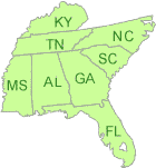
Region 4 serves Alabama, Florida, Georgia, Kentucky, Mississippi, North Carolina, South Carolina, Tennessee and 6 Tribes.
The EPA Regional Program reviews and approves or disapproves the states' 303(d) lists, and reviews and approves or disapproves state-submitted Total Maximum Daily Loads (TMDLs).
In some cases, EPA also develops TMDLs for impaired waters. EPA-developed TMDLs are posted by state. The public notice for the proposed TMDL, the proposed TMDL document and final TMDL are posted by watersheds for each state.
Public Notices in Region 4

There are no public notices at this time.
Recent Actions
Impaired Waters Rule Decision Documents
- The Florida Impaired Waters Rule establishes a methodology to identify waters that will be included on the State's Clean Water Act Section 303(d) list of impaired waters.
Floyds Fork TMDL Development (Louisville, KY)
EPA Region 4 and the Kentucky Division of Water (KDOW) Exit are developing a TMDL for the Floyds Fork watershed.
Total Maximum Daily Load Development Tools
EPA utilizes and develops modeling tools for the development of Total Maximum Daily Loads (TMDLs). These tools vary from simple spreadsheets to dynamic models. It is EPA's goal to make these tools and training on these tools available to our partner states and other interested parties. The Watershed and Water Quality Modeling Technical Support Center maintains and distributes models and tools used for the development of TMDLs.