Superfund Sites in Reuse in Missouri
If you are having trouble viewing the map in your browser, click the 'View larger map' link below
Annapolis Lead Mine
For more information:
Big River Mine Tailings/St. Joe Minerals Corp.
For more information:
Lake City Army Ammunition Plant (Northwest Lagoon)
The 3,935-acre Lake City Army Ammunition Plant (Northwest Lagoon) Superfund site is located in Independence, Missouri. Established in 1941, the site is a government-owned, contractor-operated facility used to manufacture and test ammunition for the U.S. Army. Activities at the site resulted in the contamination of ground water, soil and surface water. EPA added the site to the National Priorities List (NPL) in 1987. Cleanup activities at the site include treating ground water and sampling for chemical migration. Additional activities include placing soil cover on open waste lagoons, removing lead-contaminated sand piles, excavating soil and implementing land use restrictions. The base uses treated ground water as drinking water and process water for plant operations. The U.S. Army continues to use the site to manufacture, assemble, store and test ammunition.
For more information:
Minker/Stout/Romaine Creek
The Minker/Stout/Romaine Creek Superfund site includes about 10 acres of separate properties near the town of Imperial, Missouri. In the early 1970s, site operators sprayed dioxin-contaminated oil on the Bubbling Springs Ranch horse arena to control dust. This resulted in the illness and death of several horses. Dioxin-contaminated soil removed from the horse arena ended up as fill material in residential areas. These areas included the Minker, Stout, Cashel and Sullins residences. Much of the fill from the Minker residence eroded into Romaine Creek. In 1983, EPA detected dioxin in the soil on site and in sediments of Romaine Creek. EPA added the site to the Superfund program’s National Priorities List (NPL) in 1983 and permanently relocated 11 families affected by the contamination. Between 1985 and 1989, EPA removed about 28,420 tons of soil at the Minker area, the Sullins and Cashel residences, Romaine Creek and the Stout area. EPA sent the contaminated soil off site for incineration in 1996 and 1997. The state temporarily relocated two other families during excavation of the Minker area; they have since returned to their homes.
For more information:
Oronogo-Duenweg Mining Belt
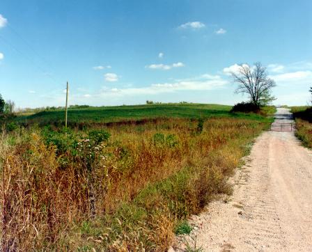
Through the efforts of EPA, the state of Missouri and the local community, the Oronogo-Duenweg Mining Belt Superfund site in Joplin, Missouri, is in productive reuse and portions are ready for redevelopment. The site is the new home of a scrap metal recycling facility, a highway bypass, restored residential neighborhoods and over 1,600 acres of cleaned land now ready for redevelopment. The mining, milling and smelting of lead and zinc ores at the site began in the 1850s and continued in some areas until the 1970s. The smelting operations dispersed airborne contaminants, resulting in the contamination of the site’s groundwater, surface water and soil with metals, including lead. By 2000, EPA had conducted a time-critical removal action to address high blood lead levels in local children and had cleaned up 2,600 residential properties and agricultural lands in surrounding communities. Also, through a Prospective Purchaser Agreement with EPA, a scrap metal recycler bought and cleaned up 40 acres of the site prior to establishing its facility there. After an agreement between EPA and the state of Missouri, the Missouri Highway and Transportation Department built the Route 249 highway bypass through four miles of contaminated land on the site in 2001. The project adaptively reused mine wastes as fill material. Cleanup of the mine waste began in 2007, and the Route 249 bypass opened to the public in 2008. EPA has developed innovative solutions for disposal of site wastes to allow for future development. Some of these solutions include: long narrow containment areas, which were built, capped and turned into three miles of new roads for Webb City; an abandoned water treatment lagoon, which was used as a disposal area and will soon become a new 36-acre sports complex in Webb City; and other containment areas, designed and built for future development, including one that will become a 40-acre truck stop. In 2009, the site received about $12.7 million in American Reinvestment and Recovery Act (ARRA) funds to support removal and disposal of the site's contaminated mining wastes, soils and sediments. The funds also supported the capping of the disposal areas, the backfilling and revegetating of excavated areas and the construction of wetlands to improve surface water cleanup. Today, workers have cleaned up more than 1,600 acres of the site that are ready for redevelopment. Community members continue to use portions of the site property for residential and agricultural purposes.
For more information:
- Redevelopment of the Orongo-Duenweg Superfund Site (PDF)(1 pg, 80 K, About PDF)
- Superfund Site Profile Page
Shenandoah Stables
The 7-acre Shenandoah Stables Superfund site is located near Moscow Mills, Missouri. In 1971, a St. Louis waste oil hauler sprayed the horse arena with about 2,000 gallons of dioxin-contaminated oil for dust control. Afterward, several adults and children became ill, and numerous birds, rodents and over 40 horses died. In 1971, site operators removed the top 6 to 8 inches of contaminated soil for use as fill material for a new highway. In 1972, site operators disposed of another 18 inches of excavated soil from the arena in a swampy area on site. EPA sampling in 1982 confirmed dioxin contamination of the arena soil. EPA added the site to the Superfund program’s National Priorities List (NPL) in 1983 and started the site cleanup in 1990. Cleanup activities included the removal and eventual off-site burning of tons of dioxin-contaminated soils. Following the removal of site contaminants, the cleanup of site storage structures and fencing further protected public health and safety. EPA deleted the site from the NPL in 2001. The site remains in use as a horse stable and a private residence.
For more information:
St. Louis Airport/Hazelwood Interim Storage/Futura Coatings Co.
The 45-acre St. Louis Airport/Hazelwood Interim Storage/Futura Coatings Co. Superfund site includes numerous properties in two areas: the St. Louis Downtown site and the North County sites. The St. Louis Downtown site is located at the Mallinckrodt Chemical Plant. The North County sites are located near the Lambert International Airport. The North County sites include the St. Louis Airport site, Hazelwood Interim Storage site and nearby properties. From 1942 to 1957, site operators processed uranium ores at the St. Louis Downtown site. Transfer of process residues to sites near the airport resulted in the contamination of many private and municipally owned properties. EPA added the site to the Superfund program’s National Priorities List (NPL) in 1989. Cleanup activities include soil removal and disposal. Covidien currently owns and operates the former Mallinckrodt, Inc. facility, part of the North County sites. Nearby on-site properties support active businesses such as a lumberyard, metal salvage and steel fabrication businesses, railroad lines, bridge structures and a portion of the earthen levee and concrete floodwall that protects the St. Louis area from Mississippi River floodwaters.
For more information:
Syntex Facility
The 180-acre Syntex Facility Superfund Site is located in a mainly agricultural area in Verona, Missouri. . Before industrial operations, the site was used for agricultural and recreational purposes. Between 1969 and 1972, North Eastern Pharmaceutical and Chemical Co. operated a soap production facility on site. This facility was later acquired by Syntex Agribusiness, Inc. (Syntex) for chemical manufacturing. Dioxin was a byproduct of site operations and dioxin residues were disposed of in several areas at the facility. Dioxin contaminated the soil on site, and fish in the downstream Spring River were also contaminated. The Syntex facility was added into the Superfund program’s National Priorities List in 1983. EPA removed contaminated soil and capped and revegetated excavated areas. The shallow aquifer in the area is available for use by rural households for domestic purposes and in some cases for agriculture. Site aquifers are used for rural household domestic purposes, water utilities and large-scale agricultural operations.
For more information:
Times Beach
The 1-square-mile Times Beach Superfund site is located 20 miles southwest of St. Louis, Missouri. The site is a formerly incorporated city that sprayed its roads with waste oil in order to control dust in the early 1970s. During a 1982 investigation, EPA discovered that the City used dioxin-contaminated oil. During the same period, the nearby Meramec River flooded the city, and residents had to evacuate their homes. Afterward, the Centers for Disease Control and Prevention recommended the permanent relocation of the evacuated residents. EPA added the site to the Superfund program’s National Priorities List (NPL) in 1983. EPA also transferred funds to the Federal Emergency Management Agency (FEMA) for the permanent relocation of residents and businesses in 1983. All residents successfully relocated by the end of 1986. After completing the permanent relocation, the state of Missouri took ownership of the site. In 1997, site cleanup activities concluded. In 1999, the restored site opened as a state park and EPA deleted the site from the NPL in 2001. The park itself provides more than 7 miles of trails for hiking, biking and equestrian use. Visitors can see a multitude of wildlife including turkey, geese, deer and more than 40 species of birds. Picnic sites abound and a boat ramp provides easy access to the Meramec River. In 2012, EPA completed a reassessment of the park to determine, in part, if any residual dioxin contamination remained above the recently revised non-cancer reference dose. The result of the reassessment concluded that current use of the Route 66 State Park does not pose significant health risks to public visitors or park workers.
For more information:
Valley Park TCE
The Valley Park TCE Superfund site is located in Valley Park, Missouri. EPA manages the site as three operable units (OUs): OU1 includes the contaminated soils on the property formerly owned by Wainwright Industries, Inc.; OU2 includes contaminated soils at the property owned by Valley Technologies, Inc. and the area-wide contaminant plume; and OU3 is the contaminated groundwater beneath OU1. OU1 and OU3 make up Wainwright Operable Unit (WOU). The selected remedy for WOU included soil vapor extraction (SVE) of contaminated soil, removal and off-site disposal of contaminated surface soil, monitoring, removal and treatment of contaminated groundwater, and institutional controls. Under EPA and State oversight, a potentially responsible party completed construction of the WOU remedy in 1999. The WOU is now in the long-term operation and maintenance phase. The OU2 remedy included removal of shallow contaminated soils, SVE of remaining contaminated soil, monitoring, removal and treatment of contaminated groundwater, and institutional controls. EPA completed construction of the OU2 remedy in 2006. Currently, a local business is located on the WOU property. Valley Technologies, Inc. continues to operate on the OU2 property. The surrounding areas have remained in continued residential and commercial use throughout the site cleanup.
For more information:
Weldon Spring Quarry/Plant/Pits (USDOE/ARMY)
The Weldon Spring Site Interpretive Center informs the public of the site's history, remedial action activities, and final conditions. The Center provides information about long-term surveillance and maintenance activities at the site, provides access to surveillance and maintenance information, and supports community involvement activities. The Center also displays a variety of exhibits including the history of the towns that once occupied the area, A timeline of significant events at the Weldon Spring Site from 1900 to the present, the legacy of the Weldon Spring Ordnance Plant and Uranium Feed Material Plant and the manufacturing wastes, the events and community efforts to clean up the site, and the people that made it happen, the multi-faceted phases of the Weldon Spring Site Remedial Action Project. These exhibits may change as appropriate due to new conditions or emerging issues at and near the site. An exhibit upgrade was completed in 2010; it included updating information in several exhibits, adding interactive and multimedia components, creating several new exhibits that address site-related topics, and improving the flow of foot traffic through the Center. A wind turbine was also installed as part of a renewable-energy demonstration project for the public. The turbine currently supplements the power for the new renewable-energy display inside the Interpretive Center. A significant number of individuals also use site amenities (e.g., the Hamburg Trail, the disposal cell perimeter road for prairie viewing, the disposal cell viewing platform, the Native Plant Education Garden).
For more information:
Wheeling Disposal Service Co., Inc., Landfill
 Wheeling Disposal Service Co., Inc., LandfillThe 20-acre Wheeling Disposal Service Co., Inc., Landfill Superfund site is located about 1 mile south of Amazonia, Missouri. Wheeling Disposal Service Company, Inc. operated a sanitary and industrial landfill on the site starting in the early 1970s. The landfill closed in 1986. Former waste disposal activities resulted in site-wide contamination. EPA field investigations detected contamination in monitoring wells, springs and soil on the site. In 1989, EPA added the site to the Superfund program’s National Priorities List (NPL). EPA’s cleanup plan included upgrading the existing landfill cap with a clay and soil cover and monitoring groundwater and surface water. During cleanup, the owner dug a pond. With assistance from the state, the owner planted native wild grasses and other foliage to attract birds and wildlife. Bordered on all sides by creeks and ravines, the site is now a habitat for wildlife and birds, often used for recreational hunting and fishing. The successful efforts of EPA, the state and the property owner resulted in the transformation of a former landfill into an important source of habitat for local flora and fauna. EPA deleted the site from the NPL in October of 2000.
For more information: