About the Watershed

The San Francisco Bay Delta watershed covers more than 75,000 square miles and includes the largest estuary on the west coasts of North and South America. It also contains the only inland delta in the world.
The watershed extends nearly 500 miles from the Cascade Range in the north to the Tehachapi Mountains in the south, and is bounded by the Sierra Mountain Range to the east and the Coast Range to the west. Nearly half of the surface water in California starts as rain or snow that falls within the watershed and flows downstream to the Pacific Ocean through the Golden Gate Strait.
In addition, the watershed provides a primary source of drinking water for 25 million Californians, irrigation for 7000 square miles of agriculture, and includes important economic resources such as California's water supply infrastructure, ports, deepwater shipping channels, major highway and railroad corridors, and energy lines. In the Delta specifically, declining water quality and increasing demand for limited water resources are the subject of intense review and planning to protect this valuable resource for the future.
The watershed includes a diversity of fresh water, brackish water, and salt water aquatic habitats. Several endangered and threatened aquatic species are found here including delta smelt, steelhead, spring run Chinook salmon, winter run Chinook salmon, and others. Two-thirds of California's salmon pass through these waters, and at least half of the state's Pacific Flyway migratory water birds rely on the region's wetlands.
EPA Uses a Watershed Approach to Protect Water Quality

EPA addresses water pollution from the watershed approach, a comprehensive framework for addressing water resource challenges. The effects of pollution and stressors (such as dams, water diversions and invasive species) in one part of an aquatic system can negatively impact other parts of the system. Restoring water quality is most effective when pollution sources, stressors and solutions are identified for the entire watershed.
The watershed approach facilitates participation from interested stakeholders, optimizes use of environmental laws, and fosters local stewardship necessary to generate and sustain water quality improvements.
Water quality problems are more completely characterized when a diverse group of stakeholders are invested in identifying sources and solutions. Science and technical information can be generated with direction from stakeholder groups and used to identify options for addressing the most pressing watershed vulnerabilities. The community investment generated by this process is important for ensuring that water quality improvements persist over time.
Major Areas of the Watershed
The San Francisco Bay Delta Watershed consists of several major waterways, including the Sacramento and San Joaquin Rivers and their tributaries. Where these two large rivers meet near Sacramento, a great inland Delta is formed where the river waters collect before passing through the Carquinez Strait into San Francisco Bay.
Besides major rivers and the Delta, the watershed also includes Suisun Bay, San Pablo Bay, San Francisco Bay and the Golden Gate Strait where the entire watershed drains into the Pacific Ocean.
- San Francisco Bay
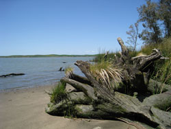
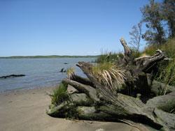 3 Mile Slough
The San Francisco Bay watershed covers 4600 square miles, of which the Bay encompasses 1600 square miles. It is the largest Pacific estuary in the Americas. The Bay Area is home to over 7 million people, and is one of the densest urban areas in the nation.
San Francisco Bay includes San Pablo Bay, Central Bay, and the South Bay. Tributary rivers that drain into the Bay include the Petaluma, Napa, Guadalupe Rivers, and numerous smaller creeks and streams.
Historically, San Francisco Bay had about 300 square miles of tidal marsh with 6000 miles of channels and 12 square miles of shallow pan. Until the 1850's, the Bay was navigable as far south as San Jose. Following the 1850's Gold Rush, large amounts of sediment from upstream erosion and hydraulic mining flowed into the Bay, and surrounding tidal wetlands were diked for salt production, hayfields, or filled in, reducing the Bay's size by as much as one-third.
The Bay is home to over 500 species of fish and wildlife, 20 of which are threatened or endangered with extinction. The Bay and its surrounding water systems play host to millions of migratory birds every year as they cross the Pacific flyway.
- The Sacramento-San Joaquin River Delta
For thousands of years, the Sacramento-San Joaquin River Delta (Delta) was a vast plain with seasonal flooding, creating 1000 square miles of brackish tidal marsh, narrow, branching tidal channels, and freshwater marshes.
Following 19th century European settlement and 20th century water supply, agricultural, and urban development, these original habitats of the Delta have been replaced by sub-sea level, levee-protected islands and simplified, deep, wide, armored waterways.
Today there are approximately 1,100 miles of levees in the Delta protecting 625 square miles of productive agricultural areas and 500,000 residents in small, rural communities and urban areas.
The mixing of fresh water and salt water (brackish water) in Suisun Bay and the Delta provides essential estuarine habitat for migratory fish like salmon and resident fishes like delta smelt and striped bass.
- The Sacramento River Watershed
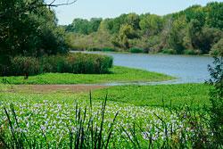 Stones Lake Wildlife Refuge
The Sacramento River Watershed is approximately 27,500 square miles and covers the majority of northern California. The watershed is bordered on the east, north, and west by mountains including the Sierra Nevada, Cascade, and Coast Ranges.
The Sacramento River is the largest river in the watershed and the longest river in California. It begins in the Cascade Range and flows over 400 miles to the south through the flat Great Central Valley where it meets the San Joaquin River forming the Delta before flowing west to the Pacific Ocean. Tributary rivers that flow into the Sacramento River include the Pit River, Butte Creek, Feather River and American River.
The lands of the Sacramento River Watershed are diverse, ranging from snow-covered peaks to low-lying agricultural areas. There are large areas of forest that cover mountain slopes, more than 3000 square miles of agriculture, and many small urban areas. The Sacramento metropolitan area covers more than 350 square miles, has a population of 2.5 million people, and is the largest urban area in the watershed.
Water flows in the Sacramento River watershed have been highly modified by 19th century gold mining, land transformation from grassland to agriculture, 20th century water supply development, and urbanization of farmland.
- The San Joaquin River Watershed
The San Joaquin River Watershed is approximately 15,600 square miles and is located in between the Sacramento River Watershed to the north and Tulare Basin Watershed to the south. The San Joaquin River watershed is bordered on the east by the Sierra Nevada Mountains and on the west by the Coast Range mountains.
The San Joaquin River is the second longest river in California. It begins in the high Sierra Nevada Mountains and flows approximately 100 miles to the west then turns north flowing for 260 miles where it joins the Sacramento River. Tributary rivers that flow into the San Joaquin River include (from south to north) the Fresno, Chowchilla, Merced, Tuolumne, Stanislaus, Calaveras, Mokelumne, and Cosumnes Rivers.
Water flows in the San Joaquin River have been substantially modified by dams and diversions that remove 95% of the water from the river at Friant Dam. These diversions cause the San Joaquin River to be dry for more than sixty miles of its course. Some stretches of the San Joaquin receive minimal amounts of agricultural and urban runoff. The Delta Mendota Canal was constructed to replenish water in the San Joaquin River by transporting Sacramento River water to Mendota Pool where it is directed to the San Joaquin River channel and agricultural users.
The land area in the San Joaquin River Watershed is diverse ranging from snow covered peaks to sub-sea level agricultural areas. There are large areas of forest that cover mountain slopes, more than 3000 square miles of agriculture in the valley, and a human population of 2 million people living in the major urban centers of Stockton and Fresno, small towns, and rural communities.
- The Tulare Lake Basin Watershed
The Tulare Lake Basin is located south of the San Joaquin River watershed bordered on the east by the Sierra Nevada Mountains, on the south by the Tehachapi Range and west by the Coast Range. Major rivers in the Tulare Lake Basin come out of the Sierra Nevada Mountains and include the Kings, Kaweah, Tule, and Kern Rivers. Smaller Sierra Nevada streams include Deer Creek, White River, and Poso Creek.
Prior to 19th century European settlement and 20th century water development, Tulare Lake Basin was characterized by four large lakes (about 800 square miles in wet years) and large tracts of wetlands (about 625 square miles) that periodically drained into the San Joaquin River watershed. Today, the large lakes and wetlands have been replaced with irrigated agriculture, rural, and urban development. Rivers that drain the Tulare Basin do not have a natural surface water pathway out of the watershed. Water moves into and out of Tulare Lake Basin by precipitation and water diversions through canals.
The Hydrology and Hydrography of Tulare Basin (136 pp, 46.4MB, About PDF) is a very useful report that describes how water flowed into and out of the Tulare Basin prior to large-scale water development and how water moves within the watershed today. Detailed maps show waterways, canals, flow direction, and locations of diversions. Hydrology of the four major river systems, the Kings, Tule, Kaweah, and Kern Rivers, are provided as well as a description of aquatic habitat, aquatic organisms, and the ability of aquatic organisms to move in and out of the Tualre Basin watershed.