RE-Powering Mapping and Screening Tools
RE-Powering Mapper
EPA’s RE-Powering Mapper, a series of Google Earth KMZ files, makes it possible to view EPA's information about renewable energy potential on contaminated lands, landfills, and mine sites, alongside other information contained in Google Earth.
Using screening criteria developed in collaboration with the U.S. Department of Energy’s National Renewable Energy Lab, EPA has pre-screened over 80,000 sites for their renewable energy potential. As part of this effort, EPA collaborated with state agencies from California, Hawaii, Illinois, Massachusetts, New Jersey, New York, Oregon, Pennsylvania, Texas, Virginia, and West Virginia. This screening was performed in August 2015.
National Maps
- Utility Scale (KMZ)(2 MB) : Sites that screened favorably for renewable energy at utility scale
- Large Scale (KMZ)(3 MB) : Sites that screened favorably for renewable energy at large scale
- Solar on Landfills (KMZ)(194 K) : Landfills that screened favorably for solar at various scales
- Completed Installations (KMZ)(146 K) : Completed renewable energy installations on contaminated lands, landfills, and mine sites
- Feasibility Studies (KMZ)(2 MB) : Sites that received a feasibility study through RE-Powering and NREL/EPA partnership
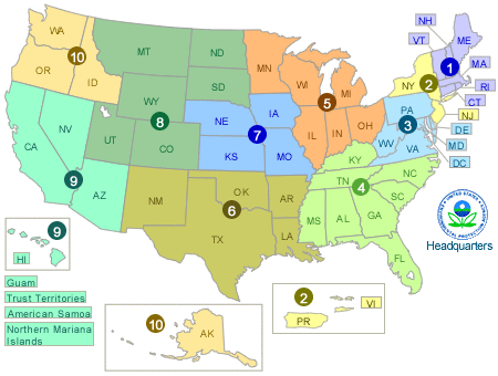
Regional Maps
Click on an EPA region to download data for that area. These maps include screened results of all technologies at all scales
Features include:
- Screening results for over 80,000 sites for solar, wind, biomass, and geothermal energy
- Search options by renewable energy at various scales, contaminated land type, or specific site names
- Site–specific reports with site information; EPA region and program managing the site; and specific acreage and renewable energy resource information.
RE–Powering Mapper GIS Shapefile (ZIP)(22 MB) The RE-Powering Mapper information can also be downloaded as a shapefile, which provides spatial locations and data used to determine renewable energy potential and associated criteria for each site. This data was used to create the RE–Powering Mapper and the national maps.
RE–Powering Mapper GIS Shapefile Metadata (XML)(23 K)
This tool was updated in August 2015. Please be sure to download the most current version.
What’s a KMZ file?
KMZ files are the file type primarily associated with Google Earth. Opening a KMZ file will automatically open Google Earth on most computers that have Google Earth installed.
Directions for using the RE–Powering Mapper
- Ensure you have Google Earth loaded onto your computer. You can download Google Earth Exit for free online.
- Download and open one of the RE–Powering Mapper’s KMZ files to launch the tool.
- In the navigation panel under RE–Powering Mapper, sites are first organized by technology and scale, then by program and site type.
- Customize your view by selecting renewable energy, site type and contaminated land type to turn layers on and off in Google Earth.
For more information on Google Earth and how to use it see the Google Earth User Guide. Exit
Other Mapping Resources
On this page:
National Maps
RE-Powering has developed a series of static maps to illustrate the renewable energy potential of contaminated lands, landfills, and mine sites on a national level. These maps are organized by technology and development scale.
- Solar Photovoltaics (PV) and Concentrated Solar Power
- Wind Energy
- Biomass
- Geothermal
- Development Scale
PVMapper
The Department of Energy’s SunShot Program’s PVMapper is a utility-scale solar site mapping Web application that is open-source and free to use. It is a geographical information system (GIS) with an easy-to-use interface that provides end users with specific information and capabilities relevant to siting large solar energy projects. PVMapper also includes the RE-Powering dataset of contaminated lands, landfills, and mine sites.
EISPC Mapping Tool
The Eastern Interconnection States Planning Council (EISPC) Energy Zones Mapping tool is a free online mapping tool to identify potential clean energy resource areas within the Eastern Transmission Interconnection. The tool enables users to identify areas with a high concentration of clean energy resources that could provide significant power generation in the future. The EISPC EZ Mapping Tool includes the RE-Powering dataset of contaminated lands, landfills, and mine sites.
Solar and Wind Site Screening Decision Trees

Learn what characteristics make a site more attractive for solar or wind energy development with RE-Powering’s Electronic Decision Tree tool.
An overview of this tool can be found in the following fact sheet.
RE–Powering Screening Dataset
EPA’s RE–Powering Screening Dataset (XLSX) (48 MB)
- Provides the data used to determine renewable energy potential for over 80,000 sites
- Allows users to screen for renewable energy potential in key markets, at different development scales, and more.
Siting Renewable Energy on Contaminated Lands
The Solar & Wind Site Screening Electronic Decision Tree builds on best practices and lessons learned from installing renewable energy projects on contaminated lands, landfills, and mine sites, which are captured in the Handbook for Siting Renewable Energy while Addressing Environmental Issues.
Solar on landfills represents one of the dominant trends in RE–Powering. Go beyond screening with the Best Practices for Siting Solar PV on MSW Landfills with considerations from the feasibility stage through design, construction, and operation.
The Data Documentation for Mapping & Screening Criteria outlines the renewable energy mapping methodology, data considerations, data sources and attributes.
Learn how to use filtering and reporting features to target sites with specific characteristics and develop custom reports with this Primer for Using RE-Powering Data to Screen Sites for Renewable Energy Potential.
This data was used to generate the maps and the RE–Powering Mapper and national maps. It can be exported for use in other mapping applications.