About Niagara River AOC
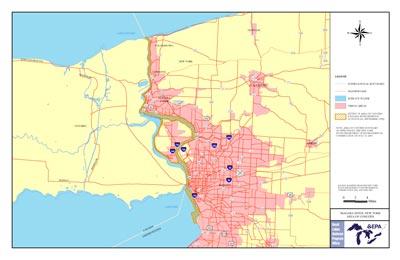 Printable Niagara River Boundary Map
The Niagara River is located in Erie and Niagara counties in western New York. In 1987 the Niagara River was designated an AOC as part of the Great Lakes Water Quality Agreement of 1987.
The area was considered highly degraded due to:
- post-industrial and municipal discharges degrading water quality and producing bottom sediment problems
- a long history of development affecting fish and wildlife habitat
- metals and cyanides in bottom sediments
- hazardous waste sites
- two Superfund sites
- contaminated discharges from Lake Erie's watershed
Habitat degradation and the survival of aquatic life in the AOC have been impaired by toxic chemicals such as PCBs, mirex, chlordane, dioxin, dibenzofuran, hexachlorocyclo-hexane, PAHs and pesticides.
The AOC includes Smokes Creek near the southern end of Buffalo Harbor, north to the mouth of the Niagara River at Lake Ontario.
Beneficial Use Impairments
- Restrictions on fish and wildlife consumption
- Fish tumors or other deformities
- Degradation of benthos
- Restriction on dredging activities
- Loss of fish and wildlife habitat
- Degradation of fish and wildlife populations
- Bird or animal deformities or reproduction problems