Aquatic Resource Descriptions
Each of the National Aquatic Resource Surveys (NARS) focuses on a particular waterbody type: coastal waters, lakes, rivers and streams, or wetlands. The descriptions of each of these resources are provided below.
- National Coastal Condition Assessment (NCCA)
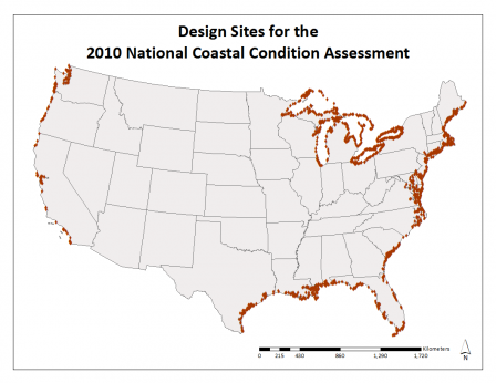 Map of the design sites for the National Coastal Condition Assessment in 2010
Both marine and Great Lakes coastal waters are included if they meet the following criteria:
Marine
- All coastal waters of the conterminous United States from the head-of-salt to confluence with the ocean, including inland waterways, tidal rivers and creeks, lagoons, fjords, bays, and major embayments such as Florida Bay and Cape Cod Bay.
- Head of salt is generally defined as < 0.5 practical salinity units (psu) and represents the landward/upstream boundary.
- The seaward boundary extends out to where an imaginary straight line intersecting two land features would fully enclose a body of coastal water.
- All waters within the enclosed area are defined as estuarine, regardless of depth or salinity.
Great Lakes
- U.S. Great Lakes shoreline area within 5 km from shore and waters 30 meters or less in depth.
- This uniquely “coastal” land-water interface zone includes: river mouths, open and semi-enclosed bays, embayments, and the more open waters adjacent to shorelines.
- It does not include the connecting channels of the Great Lakes (between lakes and the St. Lawrence River outlet).
EPA used a sample frame derived from prior National Coastal Assessments (developed by the Office of Research and Development (ORD) Gulf Breeze Ecology Division) and enhanced this using information from the National Oceanic and Atmospheric Administration (NOAA) as well as several states.
The NCCA Great Lakes sample frame was determined from existing standard GIS medium vector shoreline coverage from NOAA.
For more information: NCCA 2010 Design, NCCA 2015 Design
Special studies were undertaken in Hawaii, several U.S. Territories, and National Park Service lands in the Great Lakes.
- National Lakes Assessment (NLA)
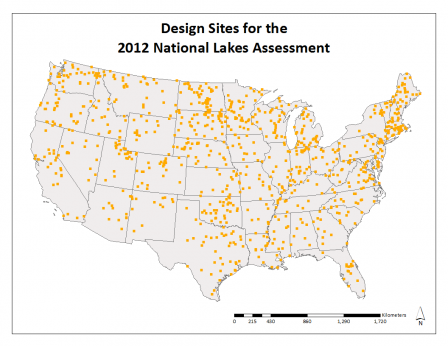 Map of the design sites for the National Lakes Assessment in 2012
For the NLA 2007, waterbodies were included if they met the following criteria:
- Natural or man-made freshwater lake, pond or reservoir
- >10 acres (4 hectares)
- At least 3.3 feet deep (1 meter)
- Minimum of a quarter acre (.1 hectare) open water.
For the NLA 2012, the size of lakes, ponds & reservoirs was decreased to those >4 acres (1 hectare).
EPA used the National Hydrography Dataset (NHD) to select lakes.
For more information: NLA 2007 Design, NLA 2012 Design
- National Rivers & Streams Assessment (NRSA)
Waterbodies were included if they met the following criteria:
- Have flowing water during the study index period excluding portions of tidal rivers up to head-of-salt. The study index period is generally characterized by base flow conditions.
- Head-of-salt is generally defined as < 0.5 practical salinity units (psu) and represents the landward/upstream boundary.
The Great Rivers, such as the Mississippi and Missouri Rivers, were included, along with run-of-the-river ponds and pools. Reservoirs were excluded.
EPA used the National Hydrography Dataset (NHD) to select rivers and streams.
For more information: NRSA 2008-09 Design, NRSA 2013-14 Design
- National Wetland Condition Assessment (NWCA)
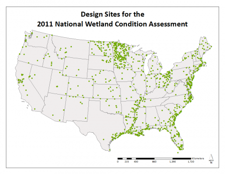 Map of the design sites for the National Wetland Condition Assessment in 2011
All tidal and nontidal wetlands of the conterminous U.S., including certain farmed wetlands not currently being used in crop production. The wetlands have rooted vegetation or, when present, shallow open water less than 1 meter in depth.
EPA employed the same base map used by the U.S. Fish and Wildlife Service (FWS) in their National Wetlands Status and Trends program to select wetland sites for sampling. The Status and Trends program uses a biological definition of wetland for their study and classifies habitats into wetland, deepwater, and upland categories. EPA used this same biological definition of wetland and the associated wetland classes for the NWCA. The following FWS Status and Trends wetland classes are included in the NWCA:
- Estuarine intertidal emergent (salt marshes)
- Estuarine intertidal forested/shrub (mangroves and other saltwater shrubs)
- Palustrine forested (forested swamps)
- Palustrine shrub (shrub wetlands)
- Palustrine emergent (inland marshes and wet meadows)
- Palustrine farmed (farmed wetlands)
- Palustrine unconsolidated bottom (open water ponds or aquatic beds)
The following FWS Status and Trends wetland classes are not included in the NWCA:
- Marine intertidal (near shore coastal waters)
- Estuarine intertidal unconsolidated shore (beaches, bars, and mudflats)
For more information: NWCA 2011 Design