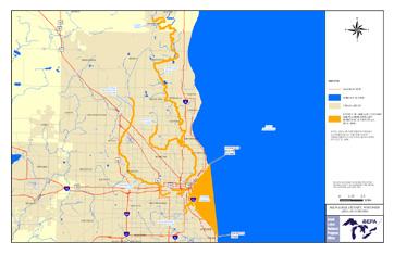
On July 18, 2008, EPA approved expanding the geographic boundaries for the Milwaukee Estuary AOC. Evidence showing contributions of toxic substances from upstream sources has accumulated since the boundaries were originally drawn in 1980. This change more accurately reflects ecosystem impacts connected with the beneficial use degradation described in the Milwaukee Estuary Remedial Action Plan and subsequent documents. Several specific expansions are included in the plan.
- Milwaukee Estuary AOC Map from Wisconsin DNR showing expanded AOC (PDF) Exit
- Milwaukee Estuary AOC GIS shapefile (zip)(8 pp, 18 K)
- Milwaukee Estuary AOC Boundary Map (2008) (PDF)(1 pg, 533 K, July 2008)