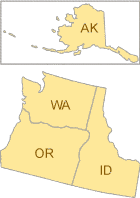
Healthy Watersheds Projects in Region 10
You will need Adobe Reader to view some of the files on this page. See EPA's PDF page to learn more.
Columbia Basin Water Transactions Program (CBWTP) ExitThe CBWTP seeks creative solutions to maintaining instream flows at ecologically acceptable levels while providing water users with sufficient supplies. Methods used include: (1) water acquisitions; (2) boosting efficiency; (3) conserving habitat; (4) rethinking the source; (5) rotational pools; and (6) water banking.
Combined Habitat Assessment Protocols ExitThe Combined Habitat Assessment Protocols (CHAP) is an accounting and appraisal tool that uses simple, yet scientifically advanced methodology to measure habitat quality (including aquatic habitats) by evaluating biodiversity within a habitat type and/or structural condition. It has been applied in the Western U.S. with its origins in transportation project mitigation. It was developed as a collaborative effort with 11 resource agencies that included: U.S. Army Corps of Engineers, Bureau of Land Management, Oregon Department of Environmental Quality, Oregon Department of Fish and Wildlife, Oregon Department of State Lands, Federal Highway Administration, NOAA Fisheries Service, State Historic Preservation Office, U.S. EPA, U.S. Forest Service and U.S. Fish & Wildlife Service.
Groundwater-Dependent Ecosystem Methods Guide (PDF) (176 pp, 6.6MB) ExitThe Nature Conservancy developed this document to assist resource managers in identifying where and when ground water is critical to sustain species and habitat diversity and what activities threaten ground water in these critical times and places in the Pacific Northwest.
Alaska
None
Idaho
None
Oregon
Stewardship Incentives: Conservation Strategies for Oregon’s Working Landscape (PDF) (140 pp, 1.2MB) ExitThis report helps landowners understand the many incentives available for conservation actions, including regulatory relief, direct financial assistance and market-based incentives.
Engaging Oregonians in Conservation: Strategy Outreach, Conservation Education and Fish and Wildlife-Based Tourism (PDF) (8 pp, 1.6MB) ExitThis report from the Oregon Department of Fish & Wildlife details objectives and opportunities in conservation education, fish and wildlife-based tourism and human dimensions research in Oregon. These approaches help to link people with their natural communities.
Oregon's Watershed Assessment Manual (PDF) (7 pp, 1.17 MB) ExitOregon's Watershed Enhancement Board prepared a manual for conducting watershed assessments to better understand watershed health, determine how human activities are impacting water quality and habitat and evaluate the effects of land management and use changes over time. The assessment manual addresses hydrology, geomorphology, biological condition, chemical and physical water quality and land use. The assessment results in a watershed condition evaluation that prioritizes sites for protection or restoration actions and provides direction for additional monitoring and assessment activities.
Oregon Biodiversity Information Center ExitExemplifying the common functions of the state natural heritage programs, the Oregon Biodiversity Information Center supports programs focusing on rare species, invasive species and natural areas in the state.
Oregon Water Quality Index ExitOregon Department of Environmental Quality developed a water quality index that aggregates subindex scores for water quality parameters including bacteria, biochemical oxygen demand, dissolved oxygen, ammonia and nitrate nitrogen, total phosphorus, pH, temperature and total solids using an unweighted harmonic square mean formula. The index is particularly sensitive to whichever parameter is most severely impaired.
Greenprint for Deschutes County, Oregon ExitDeschutes County, Oregon is one of the nation's fastest-growing counties. With no comprehensive countywide plan prioritizing the lands for conservation and recreation, the outstanding quality of life attracting entrepreneurs and new residents to the region was under increasing threat. In 2008, The Trust for Public Land, in partnership with Deschutes Land Trust, city administrators and local Parks and Recreation departments throughout the county created a Greenprint for Deschutes County. Guided by an experienced Greenprinting team, volunteers from every corner of the county came together to add their expertise and local knowledge to public and academic data about the local landscape, recreation priorities and balanced growth. The team used the information to create interactive maps that highlight and prioritize key protection areas for important scenic views, wildlife habitat and trail connections—as identified by the local people who use them. These maps and the accompanying report will help guide future conservation in all its forms, from the purchase of land and easements, to improved development planning.
Washington
Washington’s Critical Areas Growth Management Act ExitPer the state’s Growth Management Act, all cities and counties in Washington must develop regulations that protect the functions and values of critical areas, including wetlands, frequently flooded areas, fish and wildlife habitat conservation areas, areas that are critical to the recharge of aquifers that are sources of potable water and geologically hazardous areas. The state has compiled a number of documents to guide city and county officials in using the best available science to identify the functions and values of critical areas.
Protecting Aquatic Ecosystems: A Guide for Puget Sound Planners to Understand Watershed Processes ExitThis document provides guidance for Puget Sound planners, resource managers and others on how to better protect aquatic ecosystems, such as lakes, rivers, wetlands and estuaries, by including information about watershed processes in resource management plans and regulatory actions.
Puget Sound Characterization: The Water Resource Assessments (Water Flow and Water Quality) (PDF) (74 pp, 6.4MB) ExitThe Puget Sound Characterization is a set of water and habitat assessments that compare areas within a watershed for restoration and protection value. It is a coarse-scale decision-support tool that provides information for regional, county and watershed-based planning. The assessments cover water resources (both water flow and water quality) and fish and wildlife habitats (in terrestrial, freshwater, and marine nearshore areas) over the entire drainage area of Puget Sound. The assessments provide a watershed-scale perspective on the relative importance of small watersheds for the protection and restoration of water resources and habitats that is not generally provided by other available tools. Final results can also be analyzed to identify the basis for a small watershed’s relative importance, and to guide potential management strategies for that watershed. The information it provides will allow local and regional governments and others to base their decisions regarding land use on a systematic analytic framework that prioritizes specific geographic areas on the landscape as focus areas for protection, restoration and conservation of the region’s natural resources, and that also identifies areas that are likely more suitable for development.
Washington Instream Flow Program ExitWashington Department of Ecology is required by state law to retain adequate amounts of water in streams to protect and preserve instream resources and uses (such as fish, wildlife, recreation, aesthetics, water quality and navigation). One of the best water management tools for protecting stream flows is to set flow levels in regulation. Watershed management groups around the state are examining local water resources and working with Ecology to set or revise instream flows in their watersheds. The intent is to set instream flows throughout the state.