Remote Sensing and Imagery Analysis Service
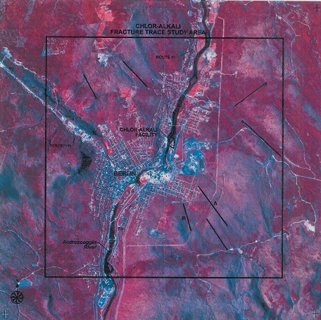 Chlor-Alkali Facility, fracture trace analysis, May 13, 1986.The Remote Sensing and Imagery Analysis Service (RSIAS) provides geographically-based data collection and analysis using technologies such as satellite imagery, aerial photography, LIDAR (Light Detection And Ranging).
Services to EPA staff include comprehensive analysis of these data, which is commonly used in support of air quality, water quality and land remediation programs. Specifically, RSIAS provides EPA with a broad set of remote sensing services, including:
- data collection
- processing
- interpretation
- digital analysis
- technical consulting
- reporting
RSIAS services help EPA make better decisions, including in hazardous waste site evaluation. The results can speed the process of remediation at Superfund and Brownfields sites, by allowing EPA to determine the exact location and extent of areas of interest.