Great Lakes Facts and Figures
The Great Lakes are, from west to east: Superior, Michigan, Huron, Erie and Ontario. They are a dominant part of the physical and cultural heritage of North America.
Shared with Canada and spanning more than 750 miles (1,200 kilometers) from west to east, these vast inland freshwater seas provide water for consumption, transportation, power, recreation and a host of other uses.
The Great Lakes are the largest surface freshwater system on the Earth. Only the polar ice caps contain more fresh water.
- 84% of North America's surface fresh water
- about 21% of the world's supply of surface fresh water
- Physical Features of the Great Lakes
- The Great Lakes Atlas Third Edition 1995 is available from NSCEP, US EPA's publication service
- Bathymetry data and maps from NOAA's Great Lakes Environmental Research Laboratory
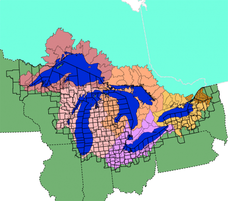 The Great Lakes Basin
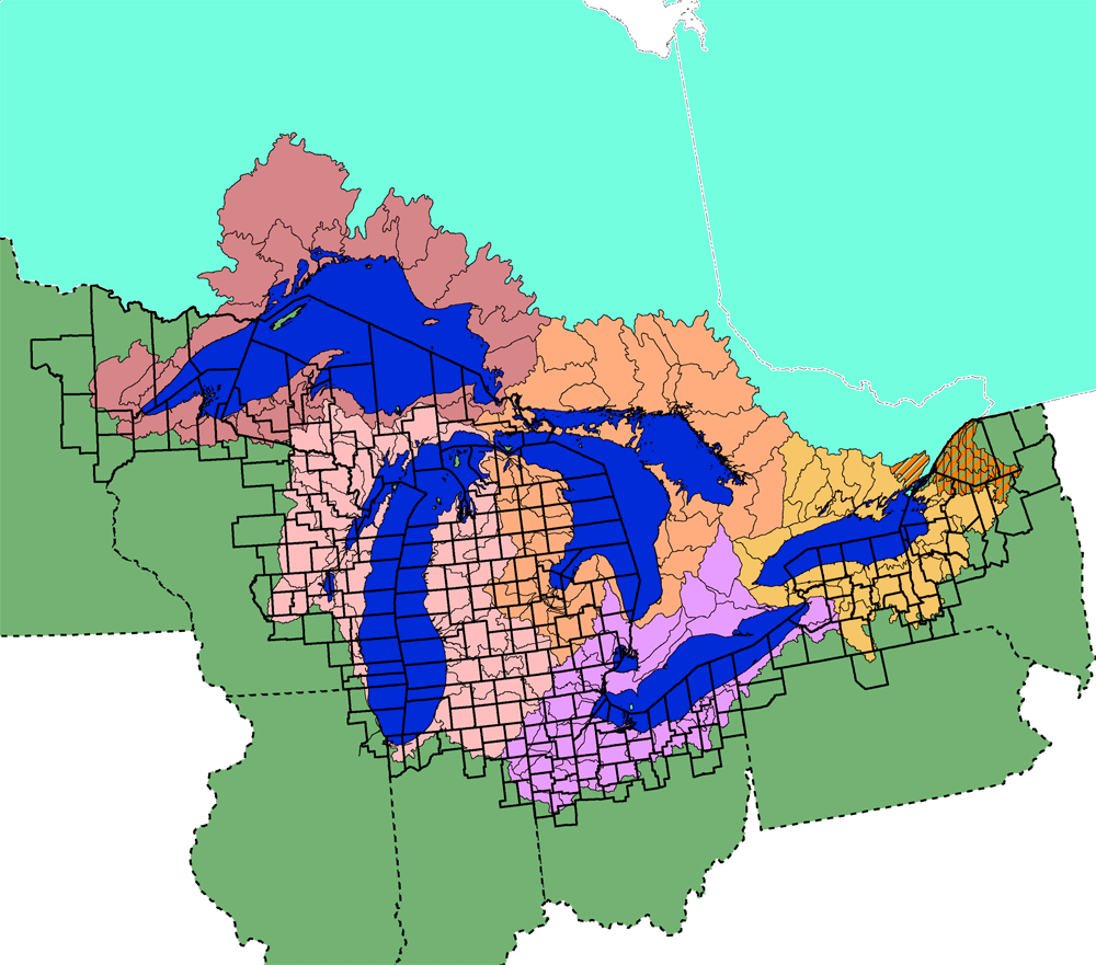
The Great Lakes basin encompasses large parts of two nations, the United States and Canada.
- Nearly 25% of Canadian agricultural production and 7% of American farm production
- Population is more than 30 million people - roughly 10% of the U.S. population and more than 30% of the Canadian population
The Great Lakes basin is defined by science, engineering and politics.
Most of the basin is defined by hydrology; watersheds that drain into the Great Lakes and their connecting channels are in the Great Lakes basin.
A combination of engineering and politics (Canadian) have resulted in the Rideau exception being included in the Great Lakes basin (the orange striped polygon on the Canadian side of the St. Lawrence River). The Clean Water Act defines the orange striped polygon on the US side as part of the Great Lakes basin (though hydrologically it drains into the St. Lawrence River).
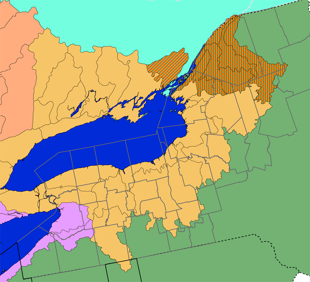
The boundaries on these two maps are defined by 8-digit Hydrologic Unit Codes (HUC8). These may change slightly as more detailed mapping is completed for these watersheds. The maps also display the counties in the Great Lakes basin.