Geophysical Lake Superior
 the largest by volume
- the deepest and coldest
- retention time = 191 years (a measure based on the volume of water in the lake and the mean rate of outflow)
- Most of the Superior basin is forested, with little agriculture because of a cool climate and poor soils.
- Sparse population
- Relatively few pollutants enter Lake Superior, except through airborne transport
Average Depth*: 483 ft.
Maximum Depth*: 1,332 ft.
Volume*: 2,900 cubic mi.
Water Area: 31,700 sq. mi.
Land Drainage Area: 49,300 sq. mi.
Shoreline Length (including islands): 2,726 mi.
* measured at low water
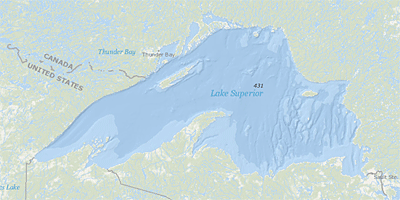
Lake Superior Map from the National Oceanic and Atmospheric Administration