GE Plant Area of the GE-Pittsfield/Housatonic River Site
Overview of the GE Plant Area
The General Electric (GE) Plant Area encompasses approximately 324 acres and consists of 10 specific Removal Action Areas (RAAs) associated with the operation of GE's Transformer, Plastics and Ordnance Divisions at the site. These RAAs have been identified based on a number of considerations, including geographic location, prior regulatory definition and status, scope and timing of response actions, current and reasonably foreseeable land use, and nature and extent of contamination. The current remediation status of the 10 RAAs is as follows:
- 9 RAAs. Remediation complete, Final Complete Report submitted and Certificate of Completion issued to GE.
- 1 RAA (Unkamet Brook Area). Remediation is underway and is expected to be substantially complete by the end of 2016.
The 10 individual GE Plant Area RAAs are described below.
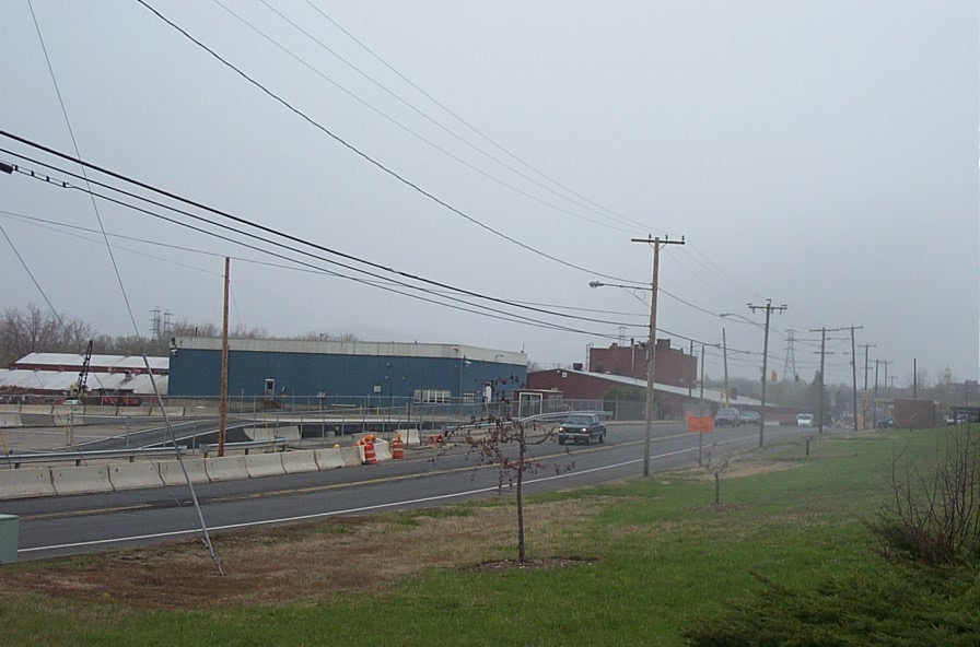
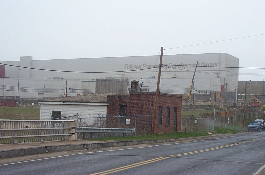
40s Complex - This RAA encompasses approximately 7 acres and is located within the western portion of GE facility. The area is generally bounded by Kellogg Street to the north, Woodlawn Avenue and other portions of the GE facility (East Street Area 2-North) to the east, railroad tracks (and a related easement by CSX, Inc.) to the south and non-GE owned commercial/industrial areas to the west. The area is mostly paved (asphalt/concrete). Prior to the lodging of the Consent Decree in 1999, Buildings 40-A, 41, and 41-A comprised much of the western portion of this area. These buildings were demolished in the early 1990s, although the subgrade portions of these buildings remain within this area. Buildings 42, 43, 43-A, and 44 comprised much of eastern portion of the area and Building 40-B was located in the central portion of this area. In 2004, GE demolished Building 40-B, and in 2005 and 2006, GE demolished Buildings 42, 43, 43-A, and 44. Approximately 19,000 cubic yards of concrete demolition debris from Buildings 42, 43, 43-A, and 44 was sampled determined to acceptable for re-use and therefore was crushed on site into a 3-inch minus aggregate. A portion of this crushed building debris was placed as structural wedges along the northern wall of the former Building 43 and eastern wall of former Building 42, to support Kellogg Street and Woodlawn Avenue, respectively. The remaining 15,000 cubic yards of crushed building debris was consolidated into an on-site stockpile located on the western portion of the RAA for potential use during re-development activities. Building debris not suitable for reuse was either transported off-site for disposal or was placed into the Hill 78 or Building 71 On-Plant Consolidation Area.
GE sampled the RAA as required in the Consent Decree and EPA has concurred with GE that no active remediation was required in this RAA. In 2009, GE performed additional actions in preparation for transferring the property to the Pittsfield Economic Development Agency (PEDA). These actions included pavement repairs and guardrail removal.
GE submitted a Final Completion Report on January 7, 2011 and EPA issued a Certificate of Completion to GE on January 24, 2011. This area is a component of the re-development agreement between GE and the City of Pittsfield and was transferred to PEDA on February 16, 2011.
PEDA and GE are currently performing all required Post-Removal Site Control Activities, including inspection, monitoring and maintenance activities. The inspection, monitoring and maintenance requirements for PEDA and GE are detailed in the Final Completion report.
30s Complex - This 15.75-acre area is located south of the 40s Complex and CSX railroad tracks. The area is generally bounded by Silver Lake Boulevard to the west, East Street and other areas of the GE facility (East Street Area 2 – South) to the south and other area of the GE facility (20s Complex) to the east. The surface of this area was historically comprised of buildings, asphalt/concrete with some unpaved areas. GE sampled the RAA as required by the Consent Decree and EPA has concurred with GE that no active remediation is required in this area. GE also demolished numerous buildings at this RAA.
GE submitted a Final Completion Report on March 18, 2005 and EPA issued a Certificate of Completion to GE on March 28, 2005. This area is a component of the re-development agreement between GE and the City of Pittsfield and was transferred to PEDA on May 2, 2005.
PEDA has since conducted significant site development activities including the removal of a majority of the pavement and concrete surfaces, installation of new drain lines, re-grading, landscaping, and construction of a water quality basin. In 2010, PEDA granted a two-acre easement to Western Massachusetts Electric Company for the construction of solar panel array. In addition to the solar panel array, a financial services business is also located on the property.
PEDA is currently performing all required Post-Removal Site Control Activities, including inspection, monitoring and maintenance activities.
20s Complex - This 10.21-acre area is located immediately east of the 30s Complex within the western portion of the GE facility. The area is generally bounded by East Street to the south and other areas of the GE facility to the north (East Street Area 2 – North) and to the east by (East Street Area 1- North). This area includes the portion of Woodlawn Avenue running from the CSX railroad tracks south to East Street. The RAA was historically comprised of buildings, asphalt/concrete with some unpaved areas. GE sampled the RAA as required by the Consent Decree and EPA has concurred with GE that no active remediation is required in this area. GE also demolished numerous buildings at this RAA.
GE submitted a Final Completion Report on March 18, 2005 and EPA issued a Certificate of Completion to GE on March 28, 2005. This area is a component of the re-development agreement between GE and the City of Pittsfield. A 9.25-acre portion of this area was transferred to PEDA on May 2, 2005. GE transferred the Woodlawn Avenue portion of this area (approximately one acre), along with northern portion of Woodlawn Avenue, to PEDA on December 16, 2011.
Since 2005, PEDA has conducted significant site development activities including the removal of a majority of the pavement and concrete surfaces, installation of new drain lines, re-grading of the property and repaving of Woodlawn Avenue.
PEDA is currently performing all required Post-Removal Site Control Activities, including inspection, monitoring and maintenance activities.
East Street Area 2 - South - This area encompasses approximately 45.4 acres of the western portion of the GE facility. The entire RAA is owned by GE. It is generally bounded by East Street to the north, Newell Street to the east, the Housatonic River to the south, and, to the west by a commercial property, a residential property, and property owned by Western Massachusetts Electric Company (which is part of the Lyman Street Area RAA). The western portion of this area is comprised mostly of the 60s Complex, and is otherwise mostly paved. GE has demolished several buildings since 2002 and a vegetative cover was installed upon the foundation slabs of some of the buildings. The eastern portion of this area contains a former Housatonic River oxbow (Oxbow H) that was formed when the river meandered through this area. This area is currently characterized as mostly open grassy areas, with a relatively small wooded area located south of the former oxbow. GE’s stormwater and groundwater treatment plants are located in this area. A 3.7 acre portion of this area adjacent to Newell Street and East Street was designated as a city recreational area, and is leased by GE to the City of Pittsfield.
The portion of riverbank adjacent to this area was subject to the Upper ½-Mile Reach Removal Action. In addition, numerous source control measures were implemented between 1999 and 2002 in the riverbank area to address the presence of non-aqueous phase liquid (NAPL).
GE completed the required sampling in the city recreational area and submitted a Removal Design/Removal Action Work Plan in December 2001 and an Addendum to the Removal Design/Removal Action Work Plan in April 2003. EPA conditionally approved these Work Plans in April 2003 and June 2003, respectively. From July 2003 through April 2004, in accordance with the EPA-approved Work Plans, GE performed the required remediation and restoration activities. The remediation activities consisted of the removal and proper disposal of approximately 501 cubic yards of soil. Restoration activities included the installation of a one-foot minimum soil cover in the recreational area, the placement of sod, the construction of a baseball field, the installation of a walking track, the installation of light towers, and the construction of a gravel access road and gravel parking lot.
GE submitted a Final Completion Report for the City Recreational Area on July 31, 2008, and EPA issued a Certificate of Completion to GE on August 27, 2008. GE agreed to lease the recreational area to the City for free and GE is currently performing all required Post-Removal Site Control Activities, including inspection, monitoring and maintenance activities.
GE subsequently completed the soil sampling for the remaining portions of East Street Area 2-South as required in the Consent Decree. GE submitted a Final Removal Design/Removal Action Work Plan in November 2009 and a Revised Final Removal Design/Removal Action Work Plan in April, 2010. EPA conditionally approved these Work Plans in February 2010 and May 2010, respectively. GE conducted response actions from June 2010 through January 2012. These actions included the removal and disposal of approximately 21,600 cubic yards of contaminated material, the installation of 4.84 acres of a vegetated engineered barrier, the installation of approximately one acre of enhanced pavement, abandonment of several storm sewer lines and utility structures and the installation of n herbaceous grassland community in a 220-foot wide riparian zone adjacent to the bank of the Housatonic River.
GE submitted a Final Completion Report for the remaining portions of East Street Area 2-South on May 8, 2013, and EPA issued a Certificate of Completion to GE on June 20, 2013. GE is currently performing all required Post-Removal Site Control Activities, including inspection, monitoring and maintenance activities.
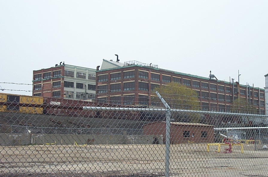
East Street Area 2 - North - This area encompasses approximately 53.4 acres and is located within the western portion of the GE facility. This area is generally bounded by Tyler Street to the north, New York Avenue to the east, the City-owned portion of Woodlawn Avenue and the 40s Complex to the west, and CSX railroad tracks and Merrill Road to the south. The 20s Complex and East Street Area 1-North are located south of Merrill Road and the CSX railroad tracks. The eastern portion of the RAA is mostly covered with buildings and pavement, intermixed with several relatively small grassy areas, including a grassy area sloping down to New York Avenue. The western portion of the RAA, also referred to as the 19s Complex, was historically comprised of buildings and asphalt/concrete, with very little unpaved grass areas.
GE has completed the sampling as required in the Consent Decree. GE submitted the Final Removal Design/Removal Action Work Plan in August 2006 and an Addendum to the Final Removal Design/Removal Action Work Plan in May 2007. EPA conditionally approved these documents in January 2007 and August 2007, respectively. In 2008, in accordance with the EPA-approved Work Plans, GE performed the required remediation and restoration activities, which consisted of the removal and proper disposal of approximately 1,200 cubic yards of soil. All of the soil removal was performed in the eastern portion of the RAA.
From 2001 through 2010, GE demolished all of the buildings on the 16.6-acre western portion of the RAA (the 19s Complex) and repaired the building slabs and deteriorated pavement. In 2010, GE placed approximately 12,500 cubic yards of crushed demolition debris (brick and concrete) in the RAA to fill in vaults, subsurface areas in structural wedges along the embankments of Tyler Street and Woodlawn Avenue, and as general grading material. The 19s Complex is now predominately covered with slabs, pavement, the crushed building debris and small vegetated area.
GE transferred Woodlawn Avenue (both the north portion, which is part of East Street Area 2-North, and the south portion, which is part of the 20s Complex), to PEDA on December 16, 2011.
GE submitted a Final Completion Report to EPA on January 6, 2012, and EPA issued a Certificate of Completion to GE on January 19, 2012. GE subsequently transferred the 19s Complex to PEDA on February 7, 2012. This brings the total amount of land transferred to PEDA to approximately 52 acres.
GE is currently performing all required Post-Removal Site Control Activities, including inspection, monitoring and maintenance activities on the GE-owned eastern portion of the RAA. GE and PEDA are performing separate post-removal site control activities on the PEDA-owned parcels.
East Street Area 1 - North - This area encompasses 5 acres and is located immediately south of East Street Area 2 - North and east of the 20s Complex. This area, is generally bounded by CSX railroad tracks and Merrill Road to the north, Merrill Road to the and west, East Street to the south, and a non-GE owned commercial property to the east. This area is mostly unpaved and formerly includes a commercial-use building, of which GE owned the western portion and a private entity owned the eastern portion. GE owns the land west of the building, where there is a NAPL containment/recovery system. CSX owns a small strip of land on the north side of the RAA between the building and the railroad tracks. GE has sampled this area as required by the Consent Decree and EPA has concurred with GE that no active remediation is required in this RAA.
GE submitted a Final Completion Report on September 27, 2005 and EPA issued a Certificate of Completion to GE on September 29, 2005. GE is currently performing all required Post-Removal Site Control Activities, including inspection, monitoring and maintenance activities.
In January and February 2012, GE demolished their portion of the commercial use building. Also during this time frame, the City of Pittsfield, which had previously condemned the western portion of the building, demolished the western portion of the building. There are no structures remaining at this RAA.
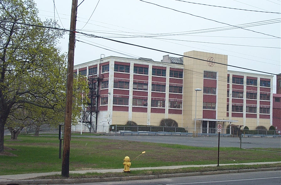
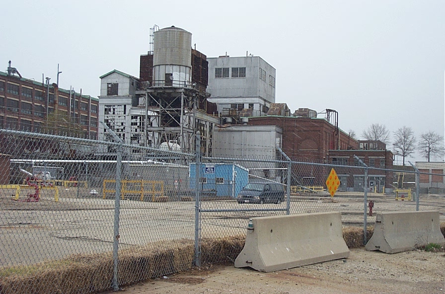
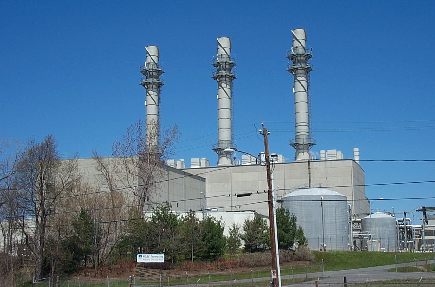
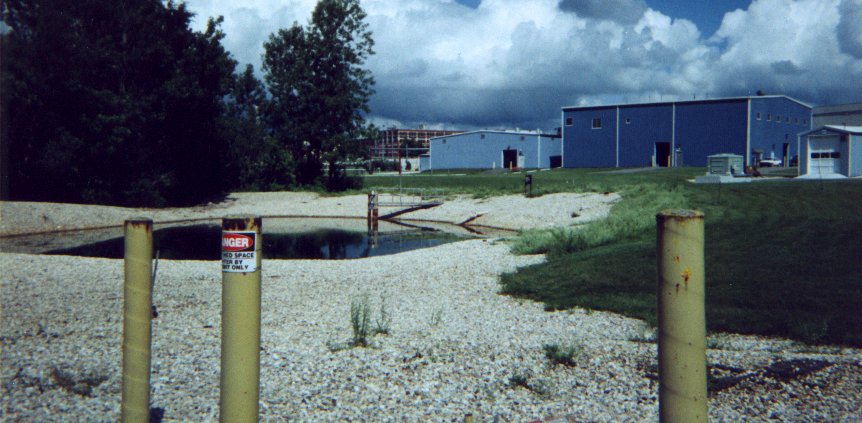
Hill 78 Area - Remainder - This area encompasses approximately 30 acres and is located in the central to eastern portion of the GE facility. The area is generally bounded by GE owned property that is not covered by the Consent Decree and Allendale School property to the north, Merrill Road to the south, New York Avenue and other areas of the GE facility (East Street Area 2 – North) to the west, and other areas of the GE facility (the General Dynamics portion of the Unkamet Brook Area) to the east. The area excludes the Hill 78 and Building 71 On-Plant Consolidation Areas (OPCAs) discussed below. Building 78 (GE’s hazardous waste storage facility), Building 14E (electrical substations) and a co-generation facility are located within this RAA. With the exception of paved roadways associated with Building 78, Building 14E and the cogeneration facility, the remainder of the RAA is generally unpaved and partially tree-covered.
GE has completed the sampling required by the Consent Decree. GE submitted the Final Removal Design/Removal Action Work Plan in June 2008 and an Addendum to the Final Removal Design/Removal Action Work Plan in September 2008. EPA conditionally approved these documents in August and October 2008, respectively. In addition, GE submitted plans to EPA to re-route sanitary and storm sewer pipelines outside the footprint of the OPCAs and through the Hill 78-Remainder RAA. EPA subsequently approved the re-routing plans. The storm drain construction and soil remediation was conducted in two phases: (1) relocation of the storm drains between October 2007 and June 2008, which included the necessary soil removal in the storm drain area to meet soil-based performance standards; and (2) in November and December 2008, the removal and restoration of soil in the remainder of the RAA. Additional restoration work was conducted in April 2010. In total, soil remediation consisted of the removal and proper disposal of approximately 1,240 cubic yards of soil.
GE submitted a Final Completion Report on August 31, 2011 and EPA issued a Certificate of Completion to GE on September 6, 2011. GE is currently performing all required Post-Removal Site Control Activities, including inspection, monitoring and maintenance activities.
Hill 78 On-Plant Consolidation Area (OPCA) - This area encompasses approximately 6 acres and is located within the boundaries of the Hill 78-Remainder RAA. It is located in the northern portion of Hill 78-Remainder Area, and is surrounded on all sides by the Hill78-Remainder RAA, except for the east, where it is bordered by the Building 71 OPCA. The Hill 78 OPCA includes the former Hill 78 landfill, which was a 15-foot tall on-site disposal area that was historically used by GE for excavated soils, building demolition and construction debris, and other materials generated within the GE facility. In 1991, GE installed a temporary cap on the former landfill that consisted of a geotextile layer covered with either one foot of crushed stone or soil.
This area was designated in the Consent Decree as a consolidation area for certain materials excavated or otherwise removed as part of various Removal Actions and building demolition debris at the GE-Pittsfield/Housatonic River Site. This area received approximately 134,500 cubic yards of materials from 1999 through 2009. (See below for more details on material placement requirements.) The area was filled to capacity and final capping was completed in 2009.
GE submitted a Final Completion Report for the Hill 78 and Building 71 OPCAs on September 15, 2011 and EPA issued a Certificate of Completion to GE on September 26, 2011. GE is currently performing all required Post-Removal Site Control Activities, including inspection, monitoring and maintenance activities.
Building 71 On-Plant Consolidation Area (OPCA) - This approximately 4.4 acre area is also located within the boundaries of the Hill 78- Remainder RAA. It is located immediately to the east of the Hill 78 OPCA. The co-generation facility is located directly to the south. This area was designated in the Consent Decree as a consolidation area for certain materials excavated or otherwise removed as part of various Removal Actions and building demolition activities at the GE-Pittsfield/Housatonic River Site. This area received approximately 110,500 cubic yards of materials from 2001 through 2006. (See below for more details on material placement requirements.) The area was filled to capacity and final capping was completed in 2006.
GE submitted a Final Completion Report for the Hill 78 and Building 71 OPCAs on September 15, 2011 and EPA issued a Certificate of Completion to GE on September 26, 2011. GE is currently performing all required Post-Removal Site Control Activities, including inspection, monitoring and maintenance activities.
Pre-Construction actions and ancillary areas associated with the Hill 78 and Building 71 On-Plant Consolidation Areas (OPCAs) – The construction of the OPCAs was preceded by the demolition of Building 71, the demolition of a structure located along the western side of the Hill 78 OPCA, and the removal and/or abandonment of storm sewers associated with Building 71. Two stormwater basins were constructed to manage the flow of clean run-off water from the OPCAs. Approximately 60 cubic yards of soil with elevated PCBs were removed from the northern stormwater basin and placed in the Building 71 OPCA. Any other disturbed soil was used as backfill or in re-grading activities - no soil was transported off site for disposal.
In addition to the area associated with the placement of materials, the two stormwater basins encompass 1.1 acres and other support areas consist of 0.65 acre. Thus, the OPCA RAAs cover a total area of approximately 12.15 acres.
Hill 78 and Building 71 On-Plant Consolidation Areas (OPCAs) Placement Requirements - Certain materials generated during the performance of Removal Actions and building demolition debris were permanently consolidated at these two OPCAs. The materials generally included soils, sediments, and existing surface materials (e.g., asphalt, other debris) that were excavated or otherwise removed as part of the Removal Actions for each RAA and building demolition debris.
Specifically excluded from consolidation within the OPCAs were free liquids, free product, intact drums and capacitors, and other equipment that contains PCBs within its internal components, as well as asbestos-containing material required by applicable law to be removed from structures prior to demolition.
Materials consolidated within the Hill 78 OPCA were limited to materials that contained less than 50 ppm PCBs, on average, and were not classified as a hazardous waste under regulations issued pursuant to the Resource Conservation and Recovery Act (RCRA). Materials that contained more than 50 ppm PCBs or were classified as a hazardous waste under regulations issued pursuant to RCRA were allowed to be consolidated at the Building 71 OPCA. The Building 71 Consolidation Area was constructed with a bottom liner and a leachate collection system.
The final cap at both of the OPCAs was a multilayered cap consisting of an impermeable high-density polyethelyne (HDPE) liner, a geosynthetic drainage composite layer, eighteen inches of sand, and six inches of top soil with a vegetative cover.
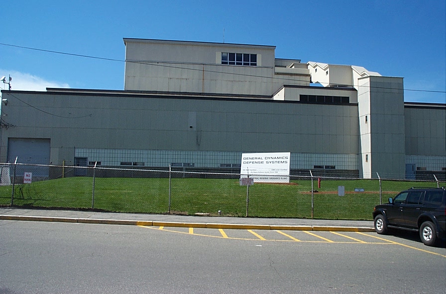
Unkamet Brook Area - This approximately 140 acre area consists of the eastern portion of the GE facility and a portion of Unkamet Brook and associated floodplain. This area also includes property located south of Merrill Road continuing to the Housatonic River. The area north of Merrill Road is bounded by Dalton Avenue to the north, Plastics Avenue and GE-owned property to the west, Merrill Road to the south and abandoned railroad tracks to the east. The area south of Merrill Road is bounded by a rail yard to the west, the Housatonic River to the south and a large wetland to the east. This area also includes commercial properties and Building OP-3 along the south side of Merrill Road.
The GE-owned portion of this area is located north of Merrill Road. The GE-owned area west of Unkamet Brook is mostly paved and covered with large buildings. The GE-owned area east of the brook and north of Merrill Road is a smaller, approximately 10-acre wetland. The Former Interior Landfill is located in the northern portion of the GE property. Prior to remediation, Unkamet Brook bisected this landfill, with the western portion of the landfill covered by the former GE Plastics parking lot and the eastern portion of the landfill extending into the wetland.
The site characterization and design phases of work for this area was split into two portions, with Unkamet Brook - West consisting of the industrial portions, and Unkamet Brook - Remainder consisting of the Former Interior Landfill, Unkamet Brook, and associated wetland. For the remediation phase, however, these two portions were merged. The Consent Decree requires, among other items, that Unkamet Brook be relocated to the east of the Former Interior landfill, the Former Interior landfill be capped, contaminated sediment and soil be removed to meet Performance Standards, and invasive wetland species be removed. The top foot of sediment in Unkamet Brook from the southern end of the relocated portion of the brook all the way to the Housatonic River (about one-half mile) will be removed and replaced with clean backfill.
This work is detailed in two Revised Final Work Plans: one dated April 2011 for Unkamet Brook-West and one dated April 2014 for Unkamet Brook-Remainder. These Work Plans call for the removal and off-site disposal at licensed landfills of approximately 34,000 cubic yards of soil, 2,000 cubic yards of sediment, and the installation of approximately 7.3 acres of engineered barriers. Remediation began in December 2014 with removal of 2 acres of invasive phragmites wetland plants along Dalton Avenue. During 2015, GE completed most of the remedial work north of Merrill Road. As of January 2016, the remaining remedial work including south of Merrill Road is expected to be completed by December 2016. All sampling results through January 2016 from project air- and water-quality monitoring have been well below project action levels.
Reports for the GE Plant Area
The following list of reports and documents has been selected to provide an overview of the environmental investigations and remedial actions conducted for the GE Plant Area. Most of the available reports and documents were produced for General Electric by their environmental consultants.
- GE Former 20s, 30s, and 40s Complexes
- GE Former 20s Complex
- GE Former 30s Complex
- GE Former 40s Complex
- East Street Area 1 – North
- East Street Area 2 – North
- East Street Area 2 – South
- City Recreational Area - subset of East Street Area 2 South
- Hill 78 Area – Remainder
- Unkamet Brook Area - Unkamet Brook Remediation
- Unkamet Brook Area - Unkamet Brook Air Monitoring Data
- Unkamet Brook Area - Unkamet Brook Reports
- GE NPDES Permit and Support Documents
- GE NPDES Discharge Monitoring Reports
- General - Documents related to more than one part of the GE Plant Area


