WhAEM2000 BBM Files - Iowa
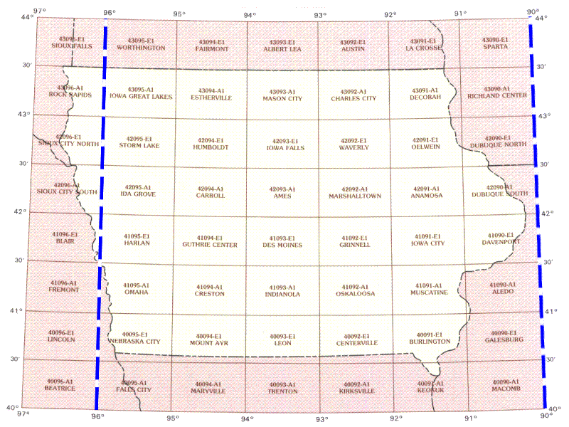
To find binary base map data for a specific geographic area, click on the appropriate 30 by 60 minute quadrangle on the state map below. A Web page containing a graphic of the 30 by 60 minute quadrangle will display eight subdivided 15 by 15 minute quadrangles. Alternatively, you can choose from an alphabetical text list of available 30 by 60 minute quadrangles.

| Aledo | Ames | Anamosa | Blair | Burlington | Carroll | Centerville | Charles City | Creston | Davenport | Decorah | Des Moines | Dubuque North | Dubuque South | Estherville | Fremont | Galesburg | Grinnell | Guthrie Center | Harlan | Humboldt | Ida Grove | Indianola | Iowa City | Iowa Falls | Iowa Great Lakes | Keokuk | Leon | Marshalltown | Mason City | Mount Ayr | Muscatine | Nebraska City | Oelwein | Omaha | Oskaloosa | Rock Rapids | Sioux City North | Sioux City South | Storm Lake | Waverly |
