WhAEM2000 BBM Files - California (North)
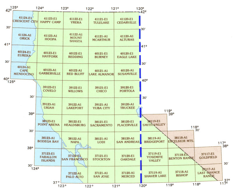
To find binary base map data for a specific geographic area, click on the appropriate 30 by 60 minute quadrangle on the state map below. A Web page containing a graphic of the 30 by 60 minute quadrangle will display eight subdivided 15 by 15 minute quadrangles. Alternatively, you can choose from an alphabetical text list of available 30 by 60 minute quadrangles.

| Alturas | Benton Range | Bishop | Bodega Bay | Bridgeport | Burney | Cape Mendocino | Cedarville | Chico | Covelo | Crescent City | Eagle Lake | Eureka | Excelsior Mountains | Farallon Islands | Garberville | Goldfield | Happy Camp | Hayfork | Healdsburg | Hoopa | Lake Almanor | Lakeport | Last Chance Range | Lodi | Mcarthur | Merced | Mount Shasta | Napa | Oakdale | Orick | Palo Alto | Placerville | Point Arena | Portola | Red Bluff | Redding | Sacramento | San Andreas | San Francisco | San Jose | Shaver Lake | Smith Valley | Stockton | Susanville | Truckee | Tulelake | Ukiah | Willows | Yosemite Valley | Yreka | Yuba City |
