Resources for Creating Healthy, Sustainable, and Equitable Communities
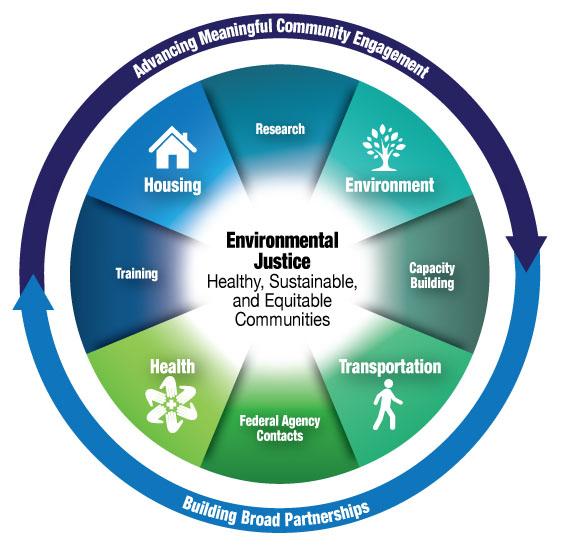
Creating healthy, sustainable, and equitable communities is a priority of the federal government. Environmental justice plays a key role in an integrated effort that simultaneously addresses housing, environment, transportation and health issues.
The Partnership for Sustainable Communities is an interagency collaboration that supports communities' efforts to expand housing and transportation choices, protect air and water, attract economic growth, and provide the type of development residents want.
The Partnership created Team EJ, a working group focused on the connections between environmental justice, health, and sustainable communities. Team EJ, co-chaired by EPA's Office of Environmental Justice and HUD's Office of Sustainable Housing and Communities, strives to better understand how EPA, HUD, DOT and CDC can integrate environmental justice, health, and sustainability goals, and use existing resources to address environmental justice needs.
Learn more about essential information about federal initiatives that address this integrated approach to environmental justice.
- Building Capacity
The Environmental Justice Funding map highlights EPA’s environmental justice grant support to communities as they develop and implement solutions that significantly address local environmental and/or public health concerns.
EJSCREEN - EJSCREEN is the environmental justice screening tool used by EPA to provide a nationally consistent dataset and methodology for calculating "EJ indexes," which highlight places that may be candidates for further review. The tool offers a variety of powerful data and mapping capabilities that enable users to access environmental and demographic information, at high geographic resolution, across the entire country.
The Cleanups in My Community enables you to map and list hazardous waste cleanup locations and grant areas, and drill down to details about those cleanups and grants and other related information.
Enforcement and Compliance History Online (ECHO) - Use EPA's ECHO website to search for facilities in your community to assess their compliance with environmental regulations. You can also investigate pollution sources, examine and create enforcement-related maps, or explore your state's performance.
Community-Focused Exposure and Risk Screening Tool (C-FERST) - C-FERST is still under development but will link to and build upon other community-focused tools, and it will provide state-of-the-science approaches for characterizing community exposures to environmental contaminants that lead to cumulative risks. These tools include information, strategies, human exposure models, databases, sampling/analytical methods, GIS maps, and web applications.
My Environment - The MyEnvironment search application is designed to provide a cross-section of environmental information based on the user's location.
AirData - AirData gives you access to air quality data collected at outdoor monitors across the United States. This tool will help you better understand air quality in your community. Other sources of air data also are available.
National Air Toxics Assessment (NATA) - NATA is EPA's ongoing comprehensive evaluation of air toxics in the U.S. EPA developed the NATA as a state-of-the-science screening tool for State/Local/Tribal Agencies to prioritize pollutants, emission sources and locations of interest for further study in order to gain a better understanding of risks.
Toxics Release Inventory (TRI) Program - provides communities with information about toxic chemical releases and waste management activities and to inform industry, government, non-government and the public on chemical releases. You can search by zip code for a report of TRI chemical releases in your neighborhood.
Federal Investments
Community Commons Exit is an interactive mapping, networking, and learning utility for the broad-based healthy, sustainable, and livable communities’ movement. Registered users have free access to hundreds of place-based community initiatives, peer-learning forums, and a variety of in tool apps.
HUD's American Recovery and Reinvestment Act (ARRA) grants map, hosted by USDA, allows you to see where HUD, USDA, and the Department of Commerce's recovery grants are being targeted.
The Transportation Infrastructure Funding Map plots Federal marine transportation system (MTS) infrastructure and intermodal connectors for the past five years. It shows both physical and informational infrastructure and incorporates investments in vessels, ports, equipment, vehicles, roads, rail, bridges, and intermodal connectors involved with the MTS.
Know Your Farmer, Know Your Food Tools and Resources shows you the local foods landscape in your community and around the country. Data includes USDA and other federally supported local food projects, farmers markets, food hubs, meat processors and more.
Federal Data
Data.gov increases the ability of the public to easily find, download, and use datasets that are generated and held by the Federal Government. Data.gov provides descriptions of the Federal datasets (metadata), information about how to access the datasets, and tools that leverage government datasets. The data catalogs will continue to grow as datasets are added.
HHS and HRSA's basic county-specific Area Resource File (ARF) is the nucleus of the overall ARF System. It is a database containing more than 6,000 variables for each of the nation's counties. ARF contains information on health facilities, health professions, measures of resource scarcity, health status, economic activity, health training programs, and socioeconomic and environmental characteristics. In addition, the basic file contains geographic codes and descriptors which enable it to be linked to many other files and to aggregate counties into various geographic groupings.
CDC's National Environmental Public Health Tracking Network (Tracking Network) is a system of integrated health, exposure, and hazard information and data from a variety of national, state, and city sources. On the Tracking Network, you can view maps, tables, and charts with data about: chemicals and other substances found in the environment; some chronic diseases and conditions; and, the area where you live.
CDC's WISQARS™ (Web-based Injury Statistics Query and Reporting System) is an interactive, online database that provides fatal and nonfatal injury, violent death, and cost of injury data from a variety of trusted sources. Researchers, the media, public health professionals, and the public can use WISQARS™ data to learn more about the public health and economic burden associated with unintentional and violence-related injury in the United States. Users can search, sort, and view the injury data and create reports, charts, and maps based intent of injury, mechanism (cause), body region, nature (type) of injury, geographic location where the injury occurred, and sex, race/ethnicity, and age of the injured person.
HUD's Community Planning and Development Maps Identify your community's needs through mapping current grant activities, local housing market and economic data, Census data, and other data sources, and see homeless grant planning data.
HUD's Empowerment Zone(EZ) & Renewal Communities (RCs)Locator has been recently modified to improve the experience for businesses and residents of EZ/RC communities. The Address Locator allows you to determine if an address is located within an Empowerment Zone or Renewal Community. This online tool can help verify if a particular location is eligible for the tax incentives or other benefits offered in EZ/RC areas. If your business in an Empowerment Zone, you may qualify for tax credits and other incentives.
HUD's Single Family Home Locator provides maps of Real-Estate Owned (REO) properties for sale, Revitalization Areas (RA), Asset Control Areas (ACA), and Neighborhood Stabilization Program (NSP) target areas.
HUD's Tribal Directory Assessment Tool (TDAT) identifies tribes and provide appropriate tribal contact information to assist with initiating Section 106 consultation.
HUD's National Housing Locator. Disaster victims use this tool to instantly find available temporary housing.
HUD's Qualified Census Tract Locator (QCT) allows users to identify whether a specific address is located in a Qualified Census Tract (QCT) for purposes of the Low-Income Housing Tax Credit (LIHTC) program. The Locator also provides information explaining why the tract was or was not designated a QCT.
DOT's EJ Links contains lists of data tools and resources can improve the ability of transportation agencies to identify and address the effects of their programs, policies and activities on low-income and minority populations. This list includes select web sites offered for your convenience in accessing related information. Linking to a web site does not constitute an endorsement by U.S. DOT, or any of its employees, of the sponsors of the site or the products presented on the site.
DOT's Transit Oriented Database is a project of the Center for Transit-Oriented Development. Intended as a tool for planners, developers, government officials, and academics, the Database provides economic and demographic information for every existing and proposed fixed guideway transit station in the U.S.
The Partnership for Sustainable Communities' Sustainable Communities HotReport is designed to give community leaders and residents a quick and easy way to determine how well your community is performing on a variety of sustainability indicators.
Grant Specific Data Tools
HUD's Choice Neighborhoods Mapping Tool allows applicants for the Choice Neighborhoods program to identify a customized area where they would target Choice Neighborhoods funds and to electronically submit that area to HUD. The tool also generates a PDF report for the custom geography with data relevant for program design.
HUD's Rural Innovation Fund assists Rural Fund applicants to prepare data to submit with their grant application by allowing applicants to draw the exact location of their target neighborhood.
HUD's Neighborhood Stabilization Project Mapping Tools allow NSP 1, 2, and 3 grantees to identify Census Tracts where are targetting their funds
HUD's Neighborhood Stabilization Project 2
- Health
Increasing access to healthy opportunities promotes healthier populations, especially those who are overburdened. Many factors are at play that influence health status and when making day-to-day health decisions. These factors include access to:
- Health care
- Green spaces
- Healthy food
- Education and jobs
- Reliable infrastructure
- Transportation choices
- Clean air, land, and water
The Centers for Disease Control Healthy Homes approach is a coordinated, comprehensive, and holistic approach to preventing diseases and injuries that result from housing-related hazards and deficiencies.
The U.S. Surgeon General's National Prevention Strategy outlines effective and achievable means for improving health and well-being. The Strategy prioritizes prevention by integrating recommendations and actions across multiple settings to improve health and save lives.
Centers for Disease Control Community Health Programs that support cross-cutting programs to prevent and control chronic diseases and improve community health.
- Transportation
Transportation options provide critical links to employment, educational opportunities, job creation and health. The links between physical activity and health are well established. Research indicates that low-income populations engage in less physical activity than the general population, and some minorities are less likely than other groups to get enough daily physical activity. These trends can be related in part to how communities and streets are designed, which has a direct effect on one's ability to be active.
Environmental Justice in Transportation: Emerging Trends and Best Practices Guidebook focuses on timely and relevant transportation issues. This case study document helps promote a deeper understanding of the responsibilities, opportunities, and benefits derived from addressing environmental justice in transportation planning and implementation.
Transportation-related Data Tools and Resources help improve the ability of transportation agencies to identify and address the effects of their programs, policies and activities on low-income and minority populations.
The Federal Highway Administration EJ Reference Guide is a resource for FHWA staff to help them ensure compliance with environmental justice requirements.
- Housing
Affordable, healthy, high-quality housing is one of the basic elements of a sustainable community. Housing choice plays an important role in reducing health, economic and quality of life disparities and leads to building thriving regions.
HUD Healthy Homes and Lead Hazard Control provides funds to state and local governments to develop cost-effective ways to reduce lead-based paint hazards. In addition, the office enforces HUD's lead-based paint regulations, provides public outreach and technical assistance, and conducts technical studies to help protect children and their families from health and safety hazards in the home.
HUD Regional Fair Housing and Equity Assessment helps stakeholders create a comprehensive picture of the housing, infrastructure, and employment dynamics that shape opportunity in their region.
HUD Environmental Review Training provide comprehensive information for grantees and staff about the various components of the environmental review process under the National Environmental Policy Act (NEPA).
- Environment
A clean environment and healthy population for all Americans, including overburdened communities, are the ultimate goals of environmental justice, smart growth and equitable development. Low-income, minority, and tribal communities historically have borne a disproportionate share of environmental harms and risks and are more likely to live in areas that increase those risks.
Addressing pollution, arranging land use, and developing sites in a manner that protects overburdened populations from environmental and health hazards, can help create safe places to live, learn, work, play and pray.
In addition to resources cited elsewhere on this site, the following …
Community Action for a Renewed Environment (CARE) Resource Guide - a tool that will enable users to navigate EPA's Web site and find information about toxics in their local communities. Under CARE, EPA worked with communities to help them come together collaboratively to investigate the toxics problems in their communities. The goals of CARE are to reduce risks and empower communities to become stewards of their own environment.
- Research
Research on environmental justice, health, and sustainability supports a continued focus on clean and safe communities to live, learn, work, play, and pray.
American Journal of Public Health Supplement on Environmental Justice and Disparities in Environmental Health Exit features a variety of scientific papers commission by EPA's Office of Environmental Justice to clarify various aspects of the state of scientific knowledge for seven factors that may contribute to environmental health disparities.
- Federal Agency Contacts
The following directories include contact information for headquarter and regional staff at the U.S. Department of Transportation (DOT), the U.S. Housing and Urban Development (HUD), EPA, and the Centers for Disease Control and Prevention (CDC), who address environmental justice, sustainability, and/or health issues. This information allows communities and stakeholders to utilize federal agency staff and resources to achieve healthy, sustainable and equitable communities.
Find HUD, DOT, and EPA regional contacts at work in your state.