Find Information about Your Beach
There are four ways you can find information about a particular beach:
- Find out which beaches are closed now or in the recent past
- Find out which beaches have health advisories now or had them in the recent past
- Find out if the water quality of a beach is currently monitored
- Learn about what EPA is doing in different regions of the country to protect beaches
Find out which beaches are closed now or in the recent past
Use BEACON’s map database to find reports of beach closures
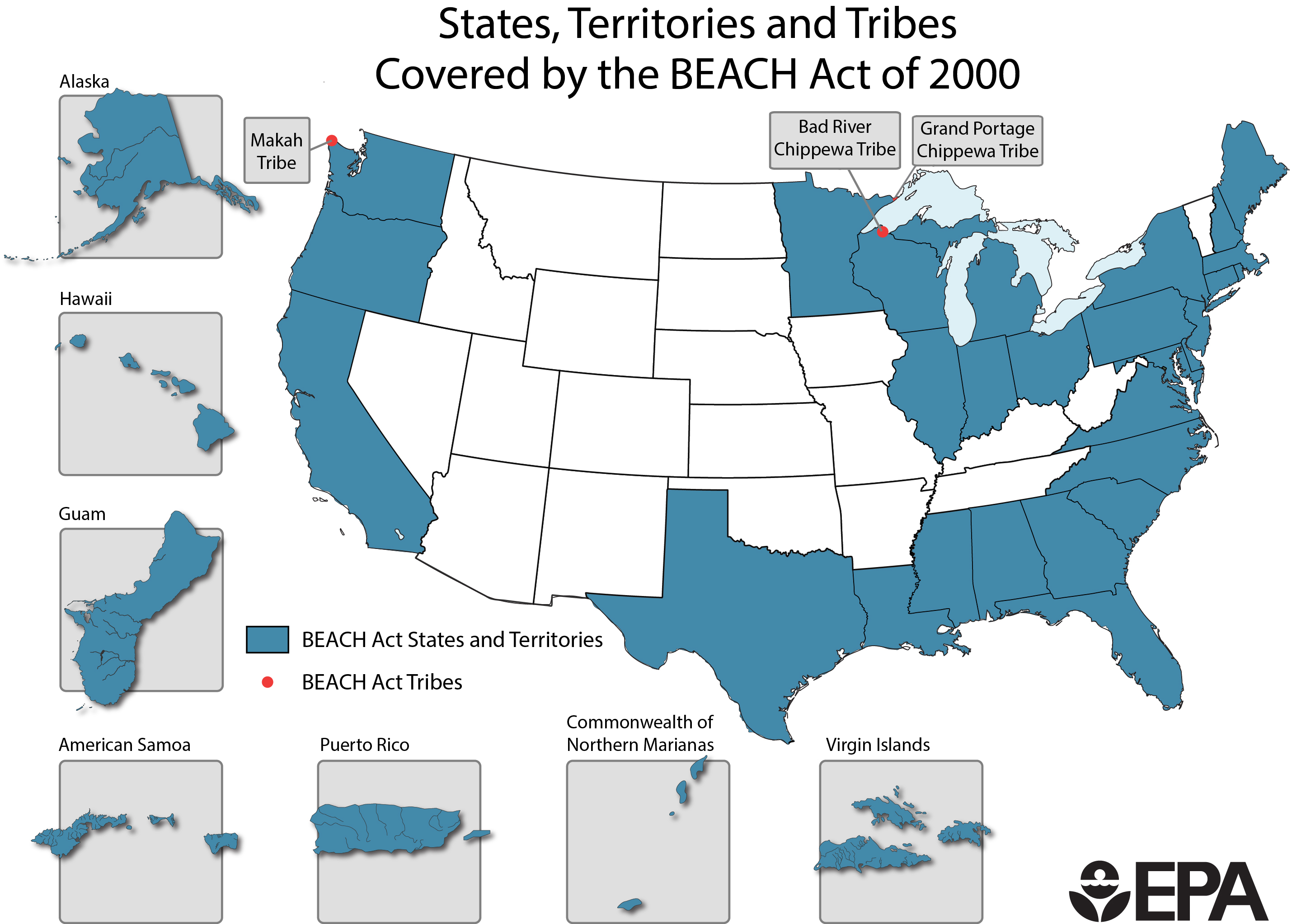
EPA’s BEACON (Beach Advisory and Closing Online Notification) is a national database that contains beach monitoring and notification data reported by states, territories, and tribes. BEACON can produce maps to show the location of over 6,000 beaches covered by the BEACH Act, and the related water quality monitoring stations, on either road maps or satellite base maps.
Information in BEACON may not be updated until January 31st for the prior swimming season. If BEACON does not have recent water quality information, please contact your state, territory, or tribe’s beach program or EPA’s regional beach contact person.
Call or email state or local beach coordinators
States, tribes, territories and local governments decide whether to open or close a beach. They report that information to EPA for inclusion in our BEACON database (see below), but it does not always reflect the most current conditions.
To find information on the current water quality for a certain beach, call your local health department or check with your state, tribe or territory beach contact.
Find out which beaches have health advisories now or had them in the recent past
Use BEACON’s map database to find reports of health advisories
EPA’s BEACON (Beach Advisory and Closing Online Notification) is a national database that contains beach monitoring and notification data reported by states, territories, and tribes. BEACON can produce maps to show the location of over 6,000 beaches covered by the BEACH Act, and the related water quality monitoring stations, on either road maps or satellite base maps.
Information in BEACON may not be updated until January 31st for the prior swimming season. If BEACON does not have recent water quality information, please contact your state, territory, or tribe’s beach program or EPA’s regional beach contact person.
Call or email state or local beach coordinators
States, tribes, territories and local governments decide whether to issue health advisories for swimming. They report that information to EPA for inclusion in our BEACON database (see below), but it does not always reflect the most current conditions.
To find information on the current water quality for a certain beach, call your local health department or check with your state, tribe or territory beach contact.
Find out if the water quality of a beach is currently monitored
Visit the interactive National List of Beaches to see where states and counties monitor
National List of Beaches provides information on beaches used by the public and whether a beach is subject to a water quality monitoring and public notification program. The list also provides beach contact information for states, territories, and tribes.
Learn about what EPA is doing in different regions of the country to protect beaches
Use the links below to see what EPA is doing in different regions of the country to protect beaches.
-
Beach Study on the Upper Columbia River (PDF) (4 pp, 910K, About PDF)