Environmental Concerns of Communities around Ambler, Pennsylvania
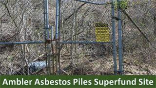
Environmental concerns around Ambler, Pennsylvania include two Superfund sites: BoRit Asbestos Superfund Site and Ambler Asbestos Piles Superfund Site, both of which are primarily contaminated with asbestos-containing waste materials. EPA works with its partners to address contamination in and around communities in Ambler, Pennsylvania.

< Previous Next >
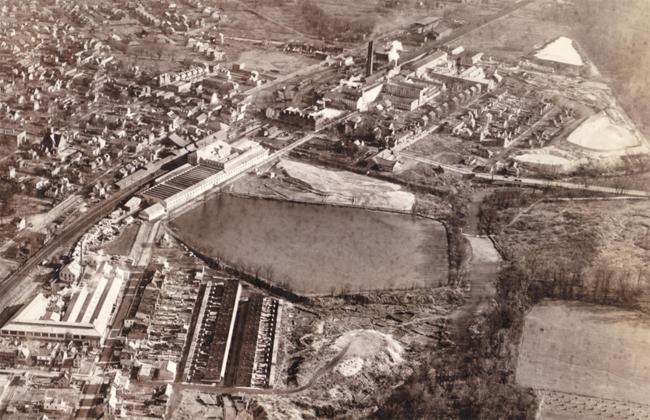 Aerial View from the 1930s of the former Keasbey and Mattison manufacturing facilities and waste disposal areas.
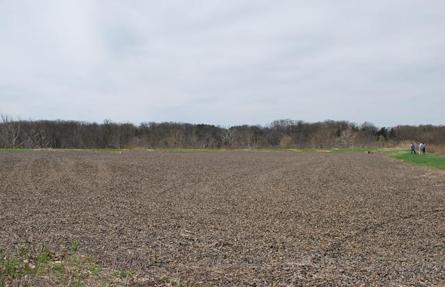 Plant Pile plateau at Ambler Asbestos site.
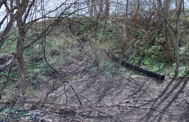 View of the drainage pipe from the upper Locust Street pile at Ambler Asbestos site.
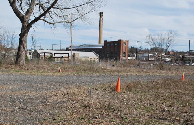 View of the Ambler Boilerhouse from the former lagoon area of Ambler Asbestos site.
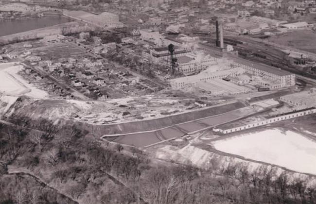 Aerial View from the 1930s of the former Keasbey and Mattison manufacturing facilities and waste disposal areas.
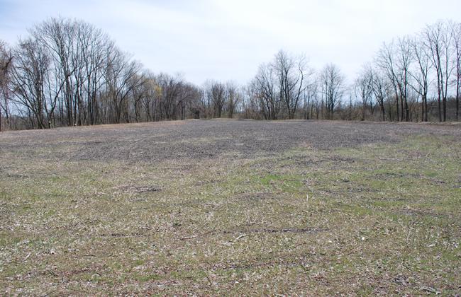 View of upper Locust Street pile plateau at Ambler Asbestos site.Plant Pile plateau at Ambler Asbestos site.
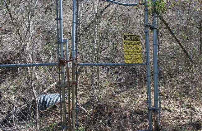 View of the fence line which runs along the Locust Street playground.
Aerial View from the 1930s of the former Keasbey and Mattison manufacturing facilities and waste disposal areas.Plant Pile plateau at Ambler Asbestos site.View of the drainage pipe from the upper Locust Street pile at Ambler Asbestos site.View of the Ambler Boilerhouse from the former lagoon area of Ambler Asbestos site.Aerial View from the 1930s of the former Keasbey and Mattison manufacturing facilities and waste disposal areas.View of upper Locust Street pile plateau at Ambler Asbestos site.Plant Pile plateau at Ambler Asbestos site.View of the fence line which runs along the Locust Street playground.< Previous Next >
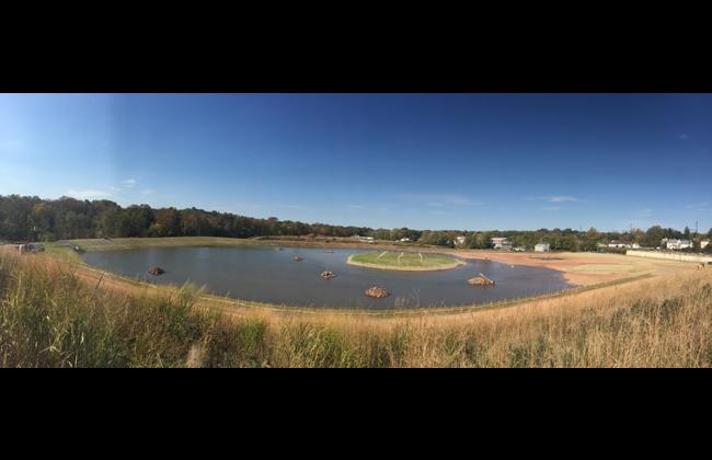 10-20-2015: View of the Wissahickon Waterfowl Preserve pond being refilled after it was reinforced and capped during EPA Removal Action. Click here to open full size image.
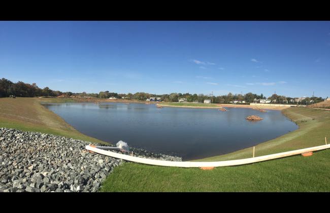 10-20-2015: View of Wissahickon Waterfowl Preserve pond showing island and rockpile enhancements constructed during Removal Action to improve habitat for migatory birds and other aquatic life. Click here to open full size image.
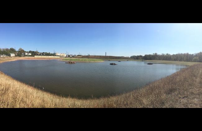 10-20-2015: Another view of the Wissahickon Waterfowl Preserve pond being refilled after it was reinforced and capped during EPA Removal Action. Click here to open full size image.
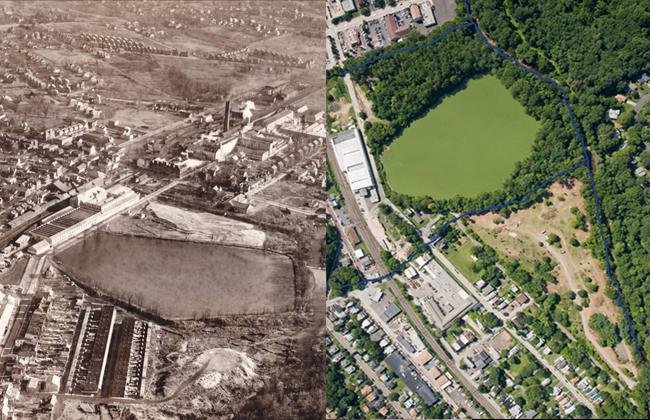 Aerial Views of BoRit. On the left is from the 1930's and on the right (2008) (©Salvatore A. Boccuti)
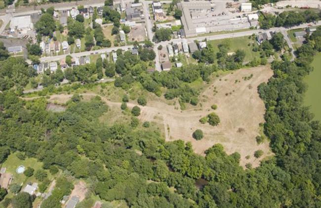 BoRit Superfund Site Park Parcel (July 2008) (©Salvatore A. Boccuti)
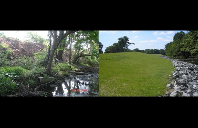 Phase I Removal Activities Before (on the left) and After (on the right).
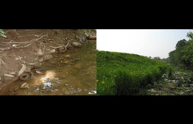 Phase 1 Removal Activities, Before (on the left) and After (on the right).
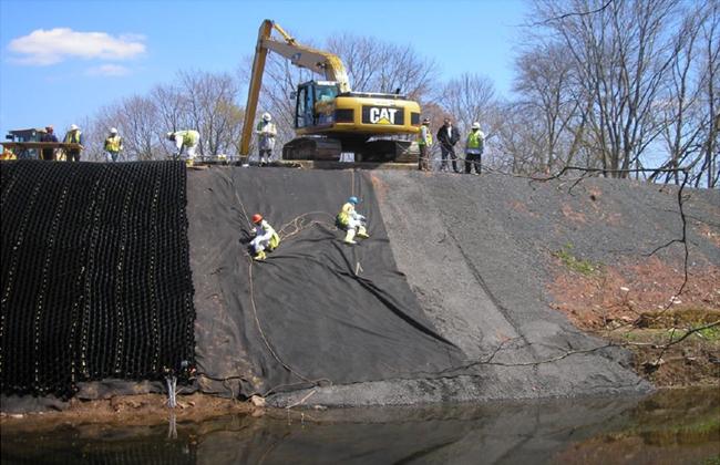 Phase 1 During Removal Activities.
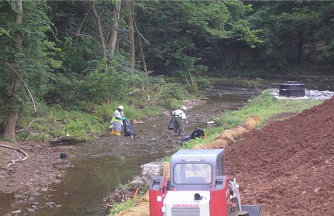 Removal of ABESTOS-Containing Materials from Rose Valley Creek (2009).
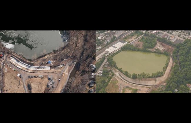 Phase 2 During Removing (on the left) and After on the right. (©Salvatore A. Boccuti).
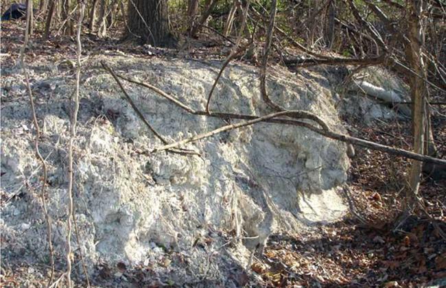 Exposed Area - Pile Property
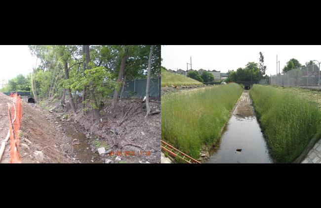 Phase IV During Removal Activities (on the left) and Open Section (on the right).
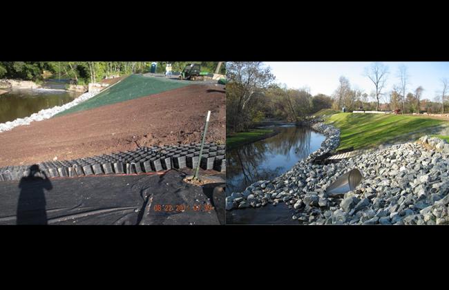 BoRit - Phase V During (on the left) and After Removal Action (on the right).
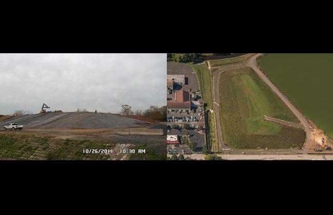 BoRit Pile During Removal Action on the left and After Capping (Approximately 2012) on the right(©Salvatore A. Boccuti).
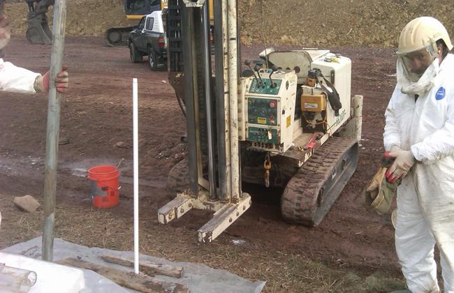 Installation of piezometers.
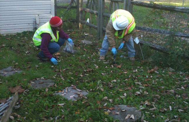 Collecting a composite soil sample on W. Maple Street.
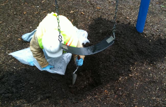 Collecting a surface soil sample underneath a swing at the Kids’ Park on Maple and Oak Street.
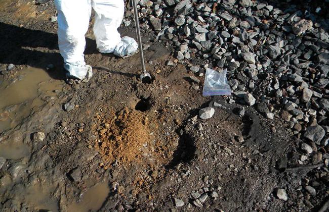 Hand augering a soil sample.
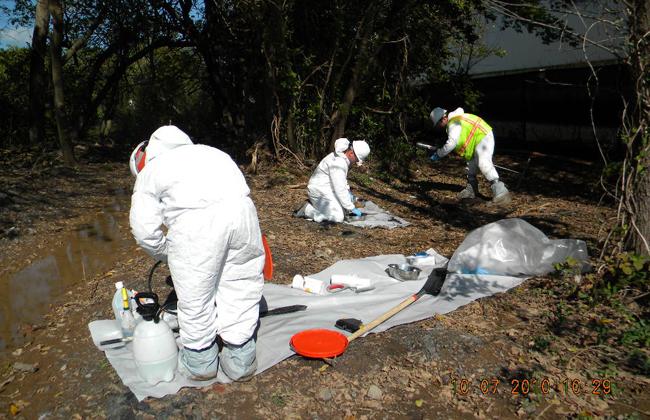 Setting up to sample “Former Fire Training” Area.
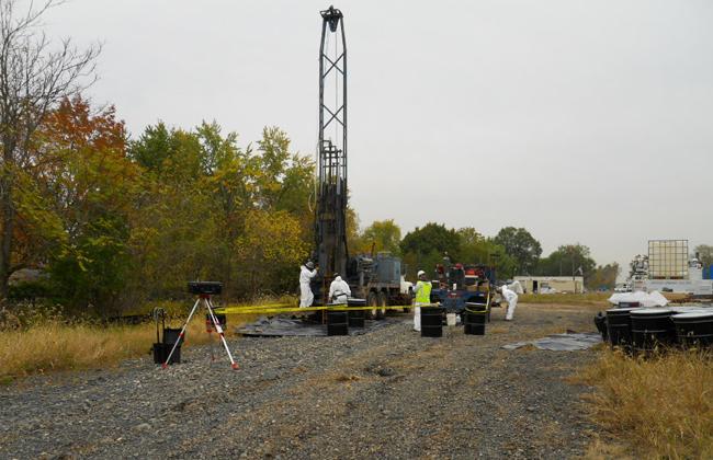 Drilling monitoring well MW-01 and air sampling.
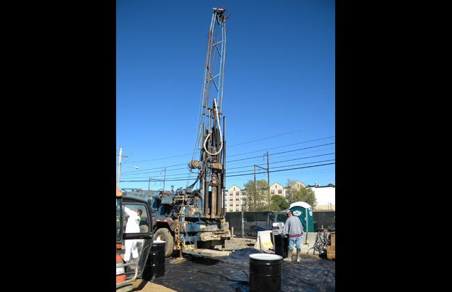 Set-up to drill monitoring well MW-6.
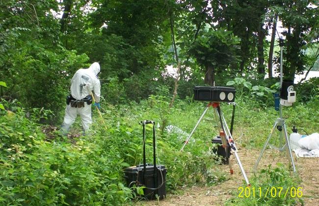 Activity Based Sampling – Raking Scenario.
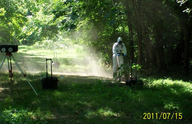 Activity Based Sampling – Mowing Scenario.
10-20-2015: View of the Wissahickon Waterfowl Preserve pond being refilled after it was reinforced and capped during EPA Removal Action. Click here to open full size image.10-20-2015: View of Wissahickon Waterfowl Preserve pond showing island and rockpile enhancements constructed during Removal Action to improve habitat for migatory birds and other aquatic life. Click here to open full size image.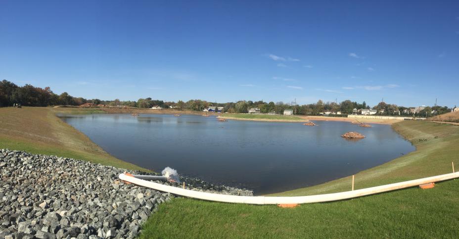 10-20-2015: Another view of the Wissahickon Waterfowl Preserve pond being refilled after it was reinforced and capped during EPA Removal Action. Click here to open full size image.Aerial Views of BoRit. On the left is from the 1930's and on the right (2008) (©Salvatore A. Boccuti)BoRit Superfund Site Park Parcel (July 2008) (©Salvatore A. Boccuti)Phase I Removal Activities Before (on the left) and After (on the right).Phase 1 Removal Activities, Before (on the left) and After (on the right).Phase 1 During Removal Activities.Removal of ABESTOS-Containing Materials from Rose Valley Creek (2009).Phase 2 During Removing (on the left) and After on the right. (©Salvatore A. Boccuti).Exposed Area - Pile PropertyPhase IV During Removal Activities (on the left) and Open Section (on the right).BoRit - Phase V During (on the left) and After Removal Action (on the right).BoRit Pile During Removal Action on the left and After Capping (Approximately 2012) on the right(©Salvatore A. Boccuti).Installation of piezometers.Collecting a composite soil sample on W. Maple Street.Collecting a surface soil sample underneath a swing at the Kids’ Park on Maple and Oak Street.Hand augering a soil sample.Setting up to sample “Former Fire Training” Area.Drilling monitoring well MW-01 and air sampling.Set-up to drill monitoring well MW-6.Activity Based Sampling – Raking Scenario.Activity Based Sampling – Mowing Scenario.
This interactive map displays boundaries of BoRit Asbestos and Ambler Asbestos Piles Superfund Sites, as well as water bodies, legislative districts and more. View a larger version of this map with additional interactive features.